2006 East Pacific Hurricane Season Name List


![[GIF]](pac_01_aletta00_plot.gif) Track Map
Track Map
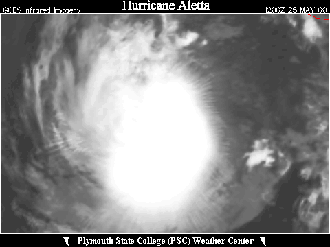
 Large Satellite View


![[GIF]](pac_02_bud00_plot.gif) Track Map
Track Map
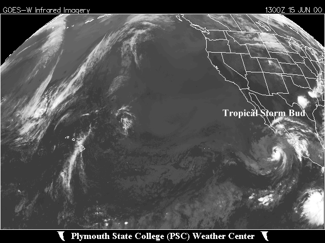 Large Satellite View


![[GIF]](pac_03_carlotta00_plot.gif) Track Map
Track Map
 Large Satellite View


![[GIF]](pac_04_four-e00_plot.gif) Track Map
Track Map
 Large Satellite View

![[GIF]](pac_05_five-e00_plot.gif) Track Map
Track Map
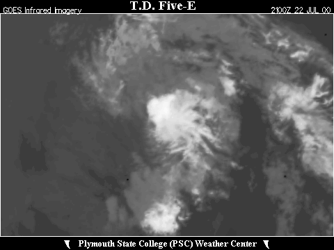
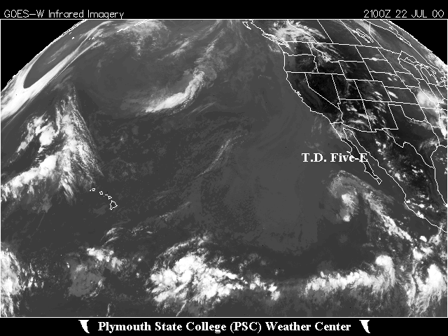 Large Satellite View


![[GIF]](pac_06_daniel00_plot.gif) Track Map
Track Map
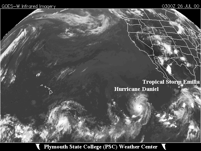 Large Satellite View

![[GIF]](pac_07_emilia00_plot.gif) Track Map
Track Map
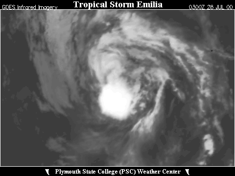
 Large Satellite View


![[GIF]](pac_08_fabio00_plot.gif) Track Map
Track Map
 Large Satellite View


![[GIF]](pac_09_gilma00_plot.gif) Track Map
Track Map
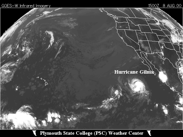 Large Satellite View
 Zoomed IR Satellite View

![[GIF]](pac_10_hector00_plot.gif) Track Map
Track Map
 Large Satellite View
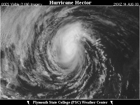
 Zoomed IR Satellite View

![[GIF]](pac_11_ileana00_plot.gif) Track Map
Track Map
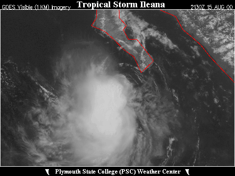
 Large Satellite View
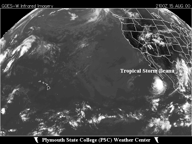
 Zoomed IR Satellite View


![[GIF]](pac_12_john00_plot.gif) Track Map
Track Map
 Large Satellite View
 Zoomed IR Satellite View

![[GIF]](pac_13_kristy00_plot.gif) Track Map
Track Map
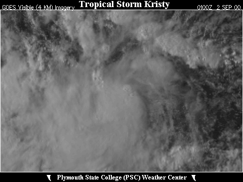
 Large Satellite View
 Zoomed IR Satellite View

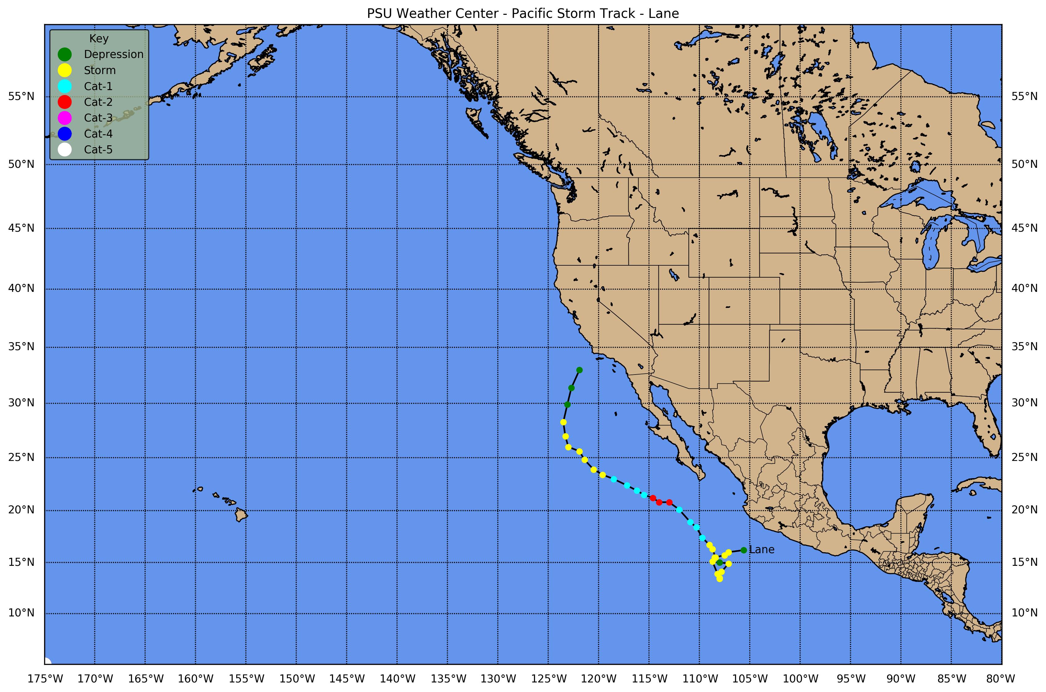
![[GIF]](pac_14_lane00_plot.gif) Track Map
Track Map
 Large Satellite View
 Zoomed IR Satellite View

![[GIF]](pac_15_miriam00_plot.gif) Track Map
Track Map
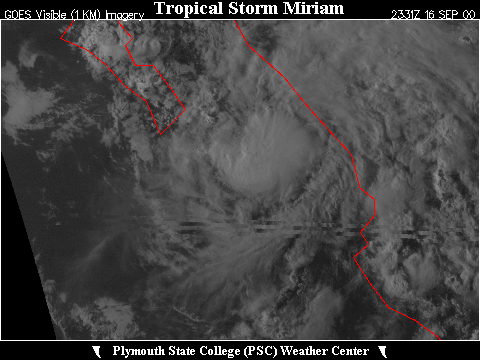
 Large Satellite View
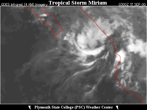 Zoomed IR Satellite View


![[GIF]](pac_16_norman00_plot.gif) Track Map
Track Map
 Large Satellite View
Zoomed VIS Satellite View
Large Satellite View
Zoomed VIS Satellite View


![[GIF]](pac_17_olivia00_plot.gif) Track Map
Track Map
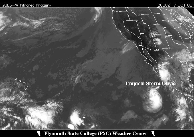 Large Satellite View
 Zoomed IR Satellite View


![[GIF]](pac_18_paul00_plot.gif) Track Map
Track Map
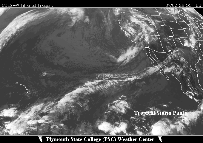 Large Satellite View
 Zoomed IR Satellite View
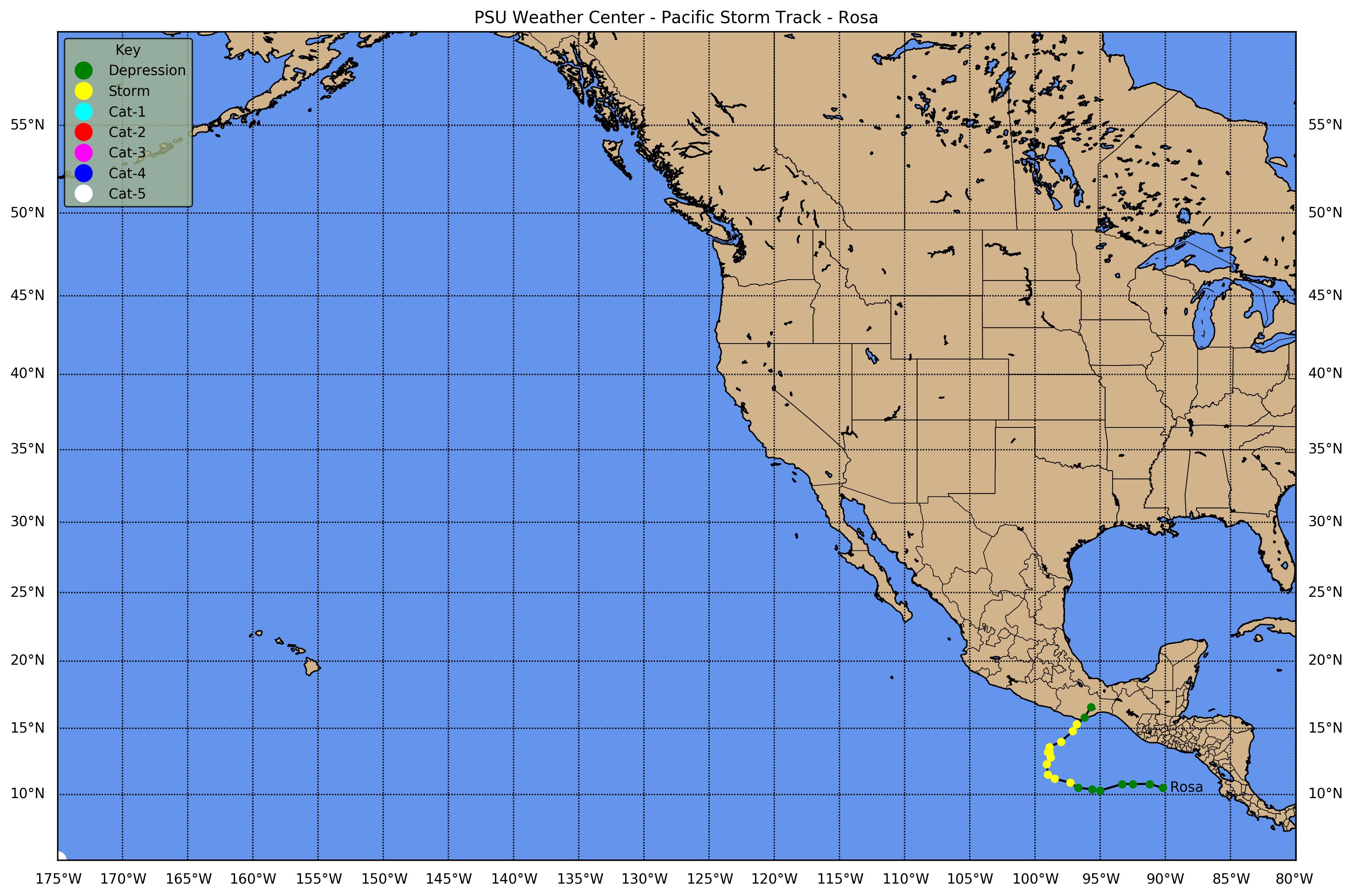
![[GIF]](pac_19_rosa00_plot.gif) Track Map
Track Map
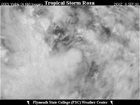
 Large Satellite View
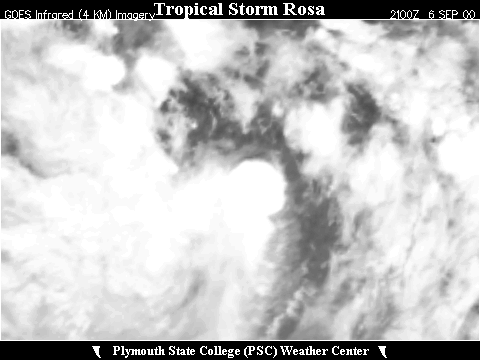 Zoomed IR Satellite View