2001 Atlantic Hurricane Season Name List


![[GIF]](atl_01_allison01_plot.gif) Track Map
Track Map
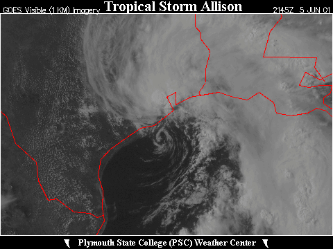
 Large Satellite View
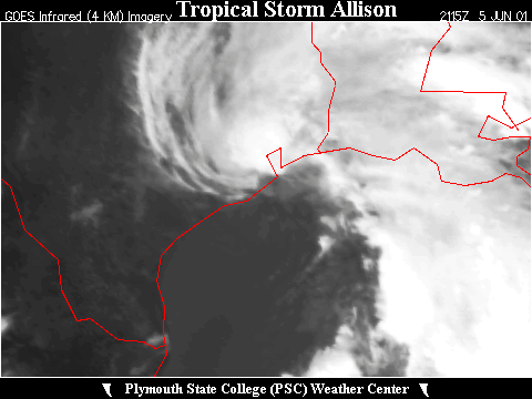 Zoomed IR Satellite View
Radar:
 New Orleans (LIX) Storm Total Precipitation


![[GIF]](atl_02_two01_plot.gif) Track Map
Track Map
 Large Satellite View
 Zoomed IR Satellite View
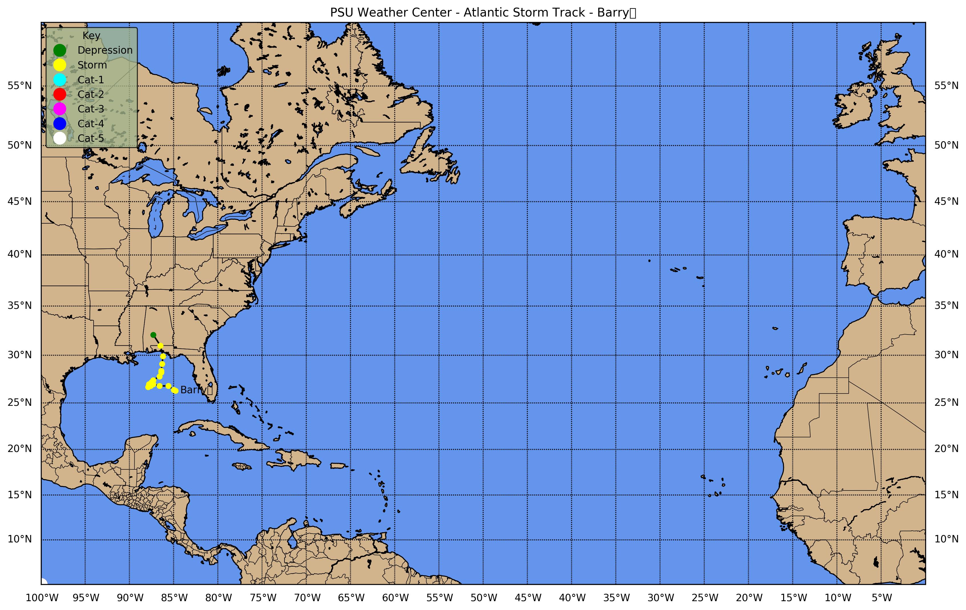
![[GIF]](atl_03_barry01_plot.gif) Track Map
Track Map
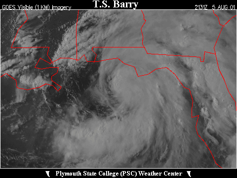
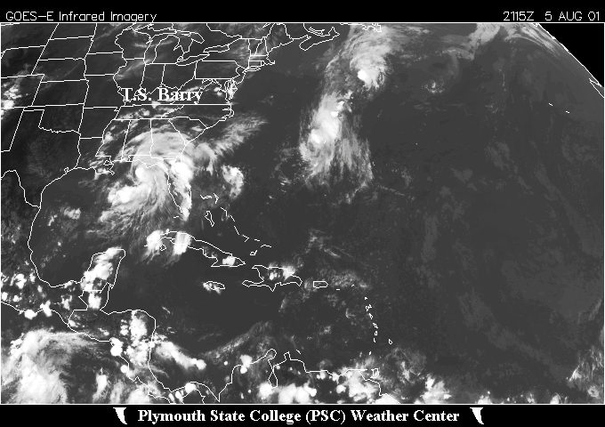 Large Satellite View
 Zoomed IR Satellite View


![[GIF]](atl_04_chantal01_plot.gif) Track Map
Track Map
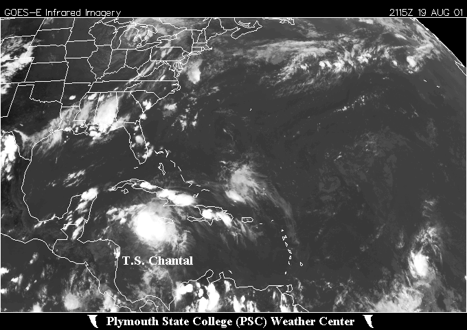 Large Satellite View
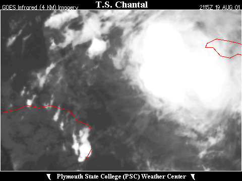 Zoomed IR Satellite View


![[GIF]](atl_05_dean01_plot.gif) Track Map
Track Map
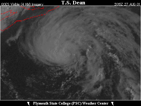
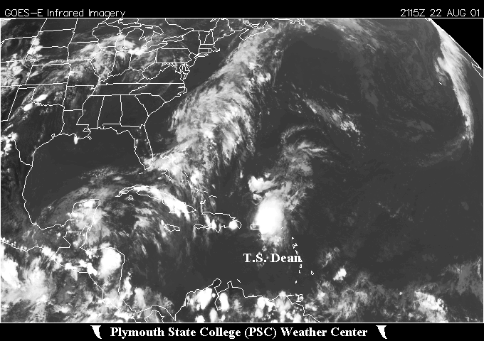 Large Satellite View
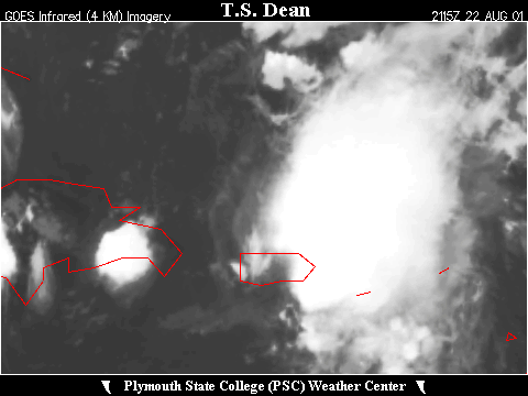 Zoomed IR Satellite View
 Track Map
 Large Satellite View
 Zoomed IR Satellite View


![[GIF]](atl_06_erin01_plot.gif) Track Map
Track Map
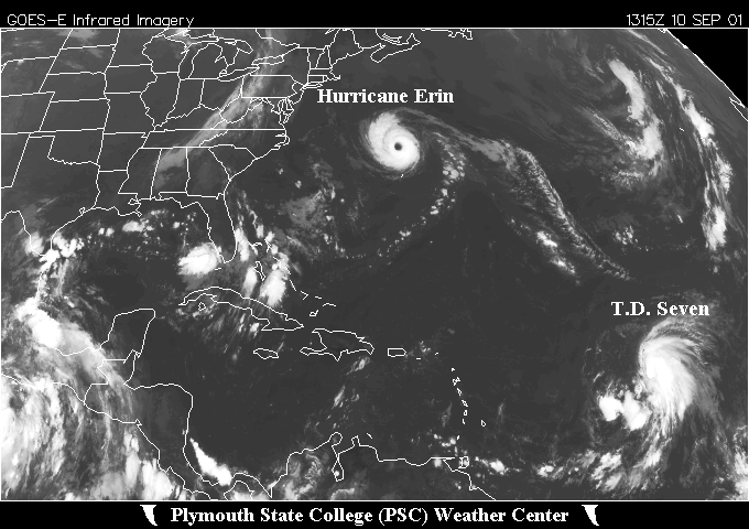 Large Satellite View
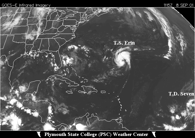
 Zoomed IR Satellite View


![[GIF]](atl_07_seven01_plot.gif) Track Map
Track Map
 Large Satellite View
 Zoomed IR Satellite View

![[GIF]](atl_07_felix01_plot.gif) Track Map
Track Map
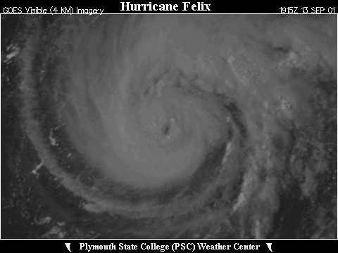
 Large Satellite View
 Zoomed IR Satellite View


![[GIF]](atl_08_gabrielle01_plot.gif) Track Map
Track Map
 Large Satellite View
 Zoomed IR Satellite View


![[GIF]](atl_09_nine01_plot.gif) Track Map
Track Map
 Large Satellite View
 Zoomed IR Satellite View

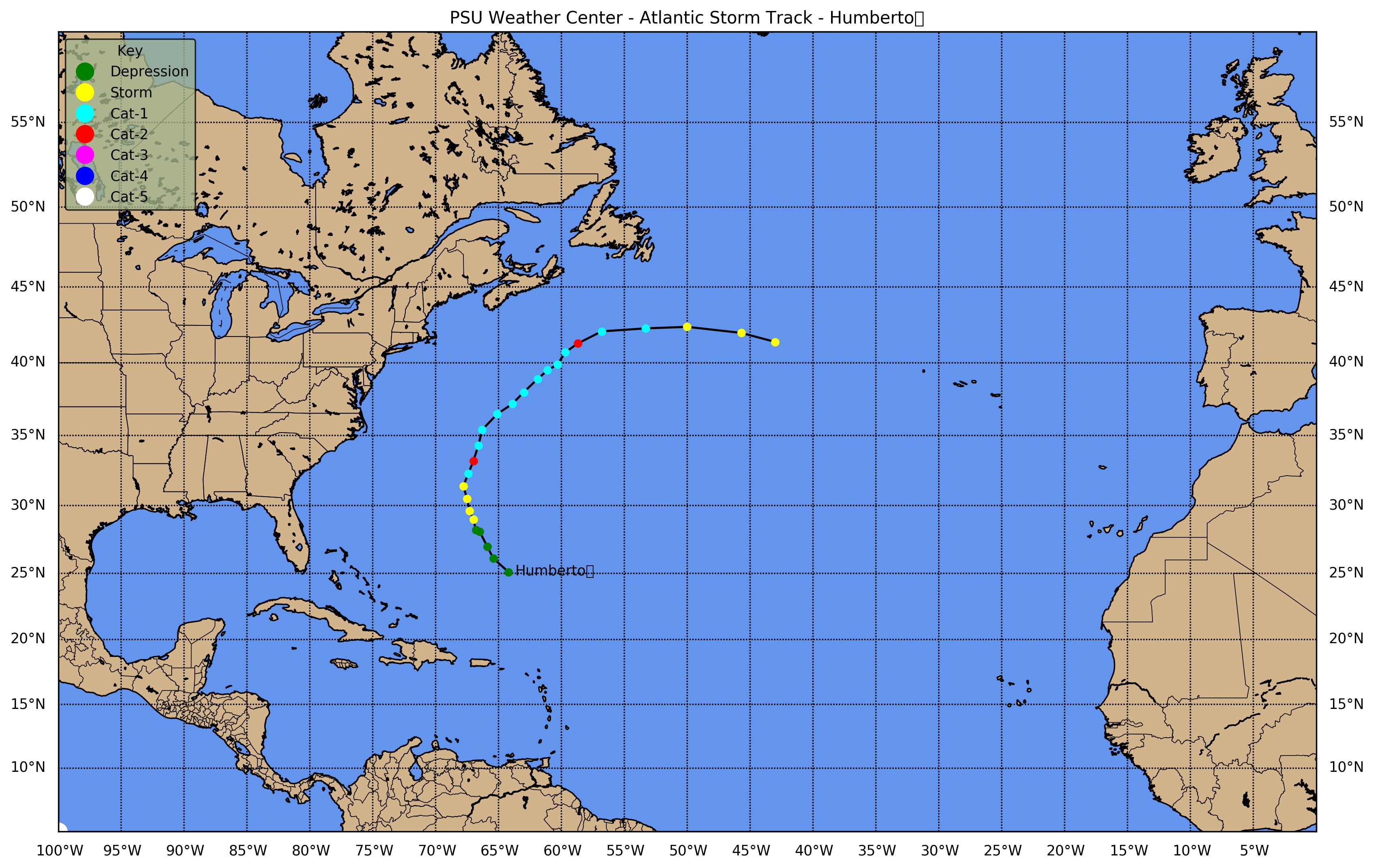
![[GIF]](atl_10_humberto01_plot.gif) Track Map
Track Map
 Large Satellite View
 Zoomed IR Satellite View


![[GIF]](atl_11_iris01_plot.gif) Track Map
Track Map
 Large Satellite View
 Zoomed IR Satellite View


![[GIF]](atl_12_jerry01_plot.gif) Track Map
Track Map
 Large Satellite View
 Zoomed IR Satellite View


![[GIF]](atl_13_karen01_plot.gif) Track Map
Track Map
 Large Satellite View
 Zoomed IR Satellite View


![[GIF]](atl_14_lorenzo01_plot.gif) Track Map
Track Map
 Large Satellite View
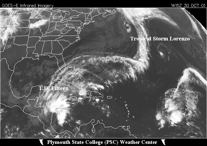
 Zoomed IR Satellite View


![[GIF]](atl_15_michelle01_plot.gif) Track Map
Track Map
 Large Satellite View
 Zoomed IR Satellite View


![[GIF]](atl_16_noel01_plot.gif) Track Map
Track Map
 Large Satellite View
 Zoomed IR Satellite View

![[GIF]](atl_17_olga01_plot.gif) Track Map
Track Map
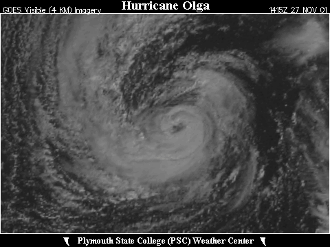
 Large Satellite View
 Zoomed IR Satellite View