2003 Atlantic Hurricane Season Name List

Tropical Storm Ana (Apr 21-24)
Tropical Depression 2 (Jun 11-12)
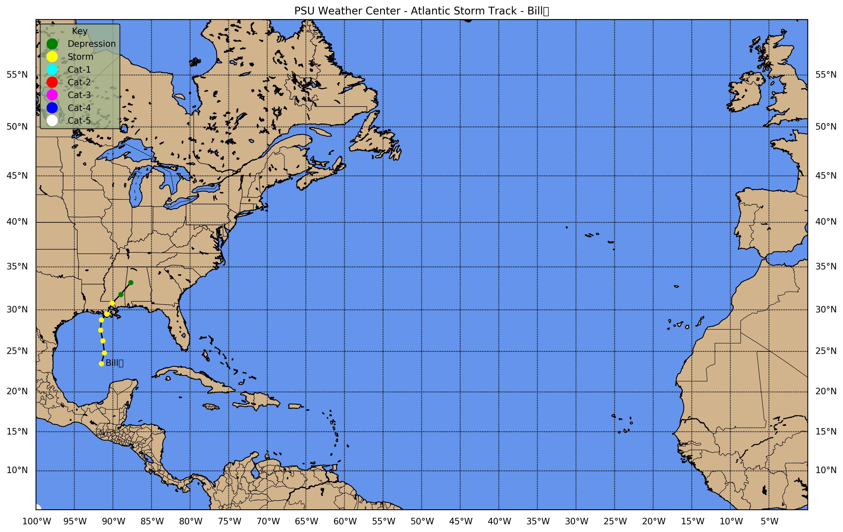
Tropical Storm Bill (Jun 29 - Jul 1)
Hurricane Claudette (Jul 8-16)
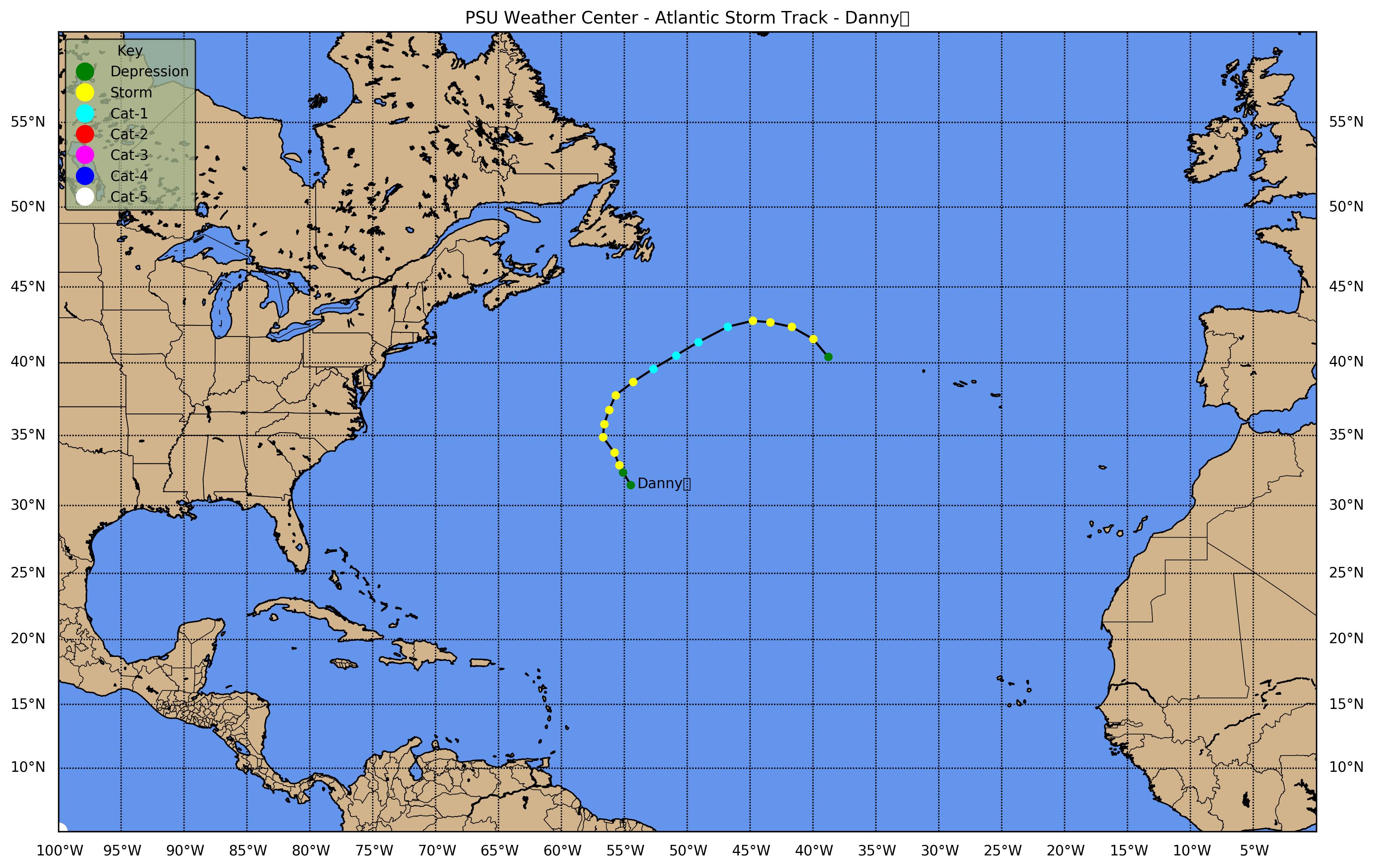
Hurricane Danny (Jul 16-20)
Tropical Depression 6 (Jul 19-21)
Tropical Depression 7 (Jul 25-26)
Tropical Storm Erika (Aug 14-17)
Tropical Depression 9 (Aug 21-22)
Hurricane Fabian (Aug 27 - Sep 8)
Tropical Storm Grace (Aug 30-31)
Tropical Storm Henri (Sep 3-8)
Hurricane Isabel (Sep 6-19)
Tropical Depression 14 (Sep 8-10)
Hurricane Juan (Sep 25-29)
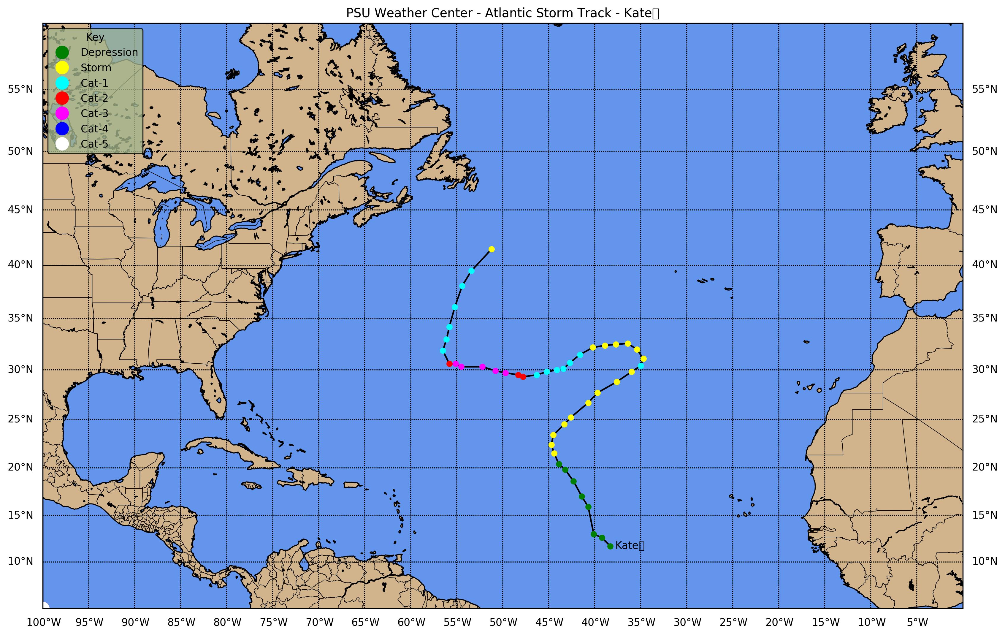
Hurricane Kate (Sep 25 - Oct 7)
Tropical Storm Larry (Oct 2-6)
Tropical Storm Mindy (Oct 10-14)
Tropical Storm Nicholas (Oct 13-23)
Tropical Storm Odette (Dec 4-7)
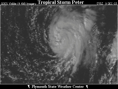
Tropical Storm Peter (Dec 9-11)
Click the above storm track map once to view a larger image and then click that image for a greatly expanded image
Tropical Storm Ana (21-24 April 2003)

[GIF] Track Map Position/Speed Summary Large Satellite View Zoomed IR Satellite View [MPG] GOES-E IR Satellite Loop
Tropical Depression Two (11-12 June 2003)

[GIF] Track Map Position/Speed Summary Large Satellite View Zoomed IR Satellite View [MPG] GOES-E IR Satellite Loop
Tropical Storm Bill (29 June - 1 July 2003)

[GIF] Track Map Position/Speed Summary Large Satellite View Zoomed IR Satellite View [MPG] GOES-E IR Satellite Loop
Radar: [MPG] NEXRAD Composite Base Reflectivity
             New Orleans (LIX) Radial Velocities New Orleans (LIX) Storm Total Precipitation Mobile (MOB) Storm Total Precipitation
Hurricane Claudette (8-16 July 2003)

[GIF] Track Map Position/Speed Summary Large Satellite View Zoomed IR Satellite View [MPG] GOES-E IR Satellite Loop
Radar: [MPG] NEXRAD Composite Base Reflectivity Houston (HGX) Radial Velocities
             Houston (HGX) Storm Total Precipitation Corpus Christi (CRP) Storm Total Precipitation
Hurricane Danny (16-20 July 2003)

[GIF] Track Map Position/Speed Summary Large Satellite View Zoomed IR Satellite View [MPG] GOES-E IR Satellite Loop
Tropical Depression Six (19-21 July 2003)

[GIF] Track Map Position/Speed Summary Large Satellite View Zoomed IR Satellite View [MPG] GOES-E IR Satellite Loop
Tropical Depression Seven (25-26 July 2003)

[GIF] Track Map Position/Speed Summary Large Satellite View Zoomed IR Satellite View [MPG] GOES-E IR Satellite Loop
Tropical Storm Erika (14-17 August 2003)

[GIF] Track Map Position/Speed Summary Large Satellite View Zoomed IR Satellite View [MPG] GOES-E IR Satellite Loop
Radar - Brownsville (BRO): [MPG] Base Reflectivity Base Reflectivity near Landfall Radial Velocity Storm Total Precipitation
Note: Posthumously (but never operationally) NHC declared Erika a hurricane.
Tropical Depression Nine (21-22 August 2003)

[GIF] Track Map Position/Speed Summary Large Satellite View Zoomed IR Satellite View [MPG] GOES-E IR Satellite Loop
Hurricane Fabian (28 August - 8 September 2003)

[GIF] Track Map Position/Speed Summary Large Satellite View Zoomed IR Satellite View [MPG] GOES-E IR Satellite Loop
Tropical Storm Grace (30-31 August 2003)

[GIF] Track Map Position/Speed Summary Large Satellite View Zoomed IR Satellite View [MPG] GOES-E IR Satellite Loop
Radar - Houston (HGX): [MPG] Base Reflectivity Base Reflectivity near Landfall Radial Velocity Storm Total Precipitation
Tropical Storm Henri (3-8 September 2003)

[GIF] Track Map Position/Speed Summary Large Satellite View Zoomed IR Satellite View [MPG] GOES-E IR Satellite Loop
Hurricane Isabel (6-19 September 2003)

[GIF] Track Map Position/Speed Summary Large Satellite View Zoomed IR Satellite View [MPG] GOES-E IR Satellite Loop
Radar: [GIF] NEXRAD Composite Base Reflectivity [MPG] Morehead City (MHX) Radial Velocity
            Morhead City (MHX) Storm Total Precipitation Newport News (AKQ) Precipitation
Meteogram: Cherry Point, NC
Tropical Depression Fourteen (8-10 September 2003)
This system stayed too far east to obtain GOES East satellite coverage

[GIF] Track Map Position/Speed Summary
Hurricane Juan (25-29 September 2003)

[GIF] Track Map Position/Speed Summary Large Satellite View Zoomed IR Satellite View [MPG] GOES-E IR Satellite Loop
Meteogram: Halifax, NS
Hurricane Kate (25 September - 7 October 2003)

[GIF] Track Map Position/Speed Summary Large Satellite View Zoomed IR Satellite View [MPG] GOES-E IR Satellite Loop
Tropical Storm Larry (2-6 October 2003)

[GIF] Track Map Position/Speed Summary Large Satellite View Zoomed IR Satellite View [MPG] GOES-E IR Satellite Loop
Tropical Storm Mindy (10-14 October 2003)

[GIF] Track Map Position/Speed Summary Large Satellite View Zoomed IR Satellite View [MPG] GOES-E IR Satellite Loop
Tropical Storm Nicholas (13-23 October 2003)

[GIF] Track Map Position/Speed Summary Large Satellite View Zoomed IR Satellite View [MPG] GOES-E IR Satellite Loop
Tropical Storm Odette (4-7 December 2003)

[GIF] Track Map Position/Speed Summary Large Satellite View Zoomed IR Satellite View [MPG] GOES-E IR Satellite Loop
Tropical Storm Peter (9-11 December 2003)

[GIF] Track Map Position/Speed Summary Large Satellite View Zoomed IR Satellite View [MPG] GOES-E IR Satellite Loop