2007 Atlantic Hurricane Season Name List


![[GIF]](atl_01_andrea07_plot.gif) Track Map
Track Map
 Large Satellite View
 Zoomed IR Satellite View


![[GIF]](atl_02_barry07_plot.gif) Track Map
Track Map
 Large Satellite View
 Zoomed IR Satellite View
Radar:

![[GIF]](atl_03_chantal07_plot.gif) Track Map
Track Map
 Large Satellite View
 Zoomed IR Satellite View

![[GIF]](atl_04_dean07_plot.gif) Track Map
Track Map
 Large Satellite View
 Zoomed IR Satellite View


![[GIF]](atl_05_erin07_plot.gif) Track Map
Track Map
 Large Satellite View
 Zoomed IR Satellite View
![[GIF]](atl_05_erin07_sat.gif) GOES-E IR Satellite Loop
GOES-E IR Satellite Loop

![[GIF]](atl_06_felix07_plot.gif) Track Map
Track Map
 Large Satellite View
 Zoomed IR Satellite View


![[GIF]](atl_07_gabrielle07_plot.gif) Track Map
Track Map
 Large Satellite View
 Zoomed IR Satellite View


![[GIF]](atl_08_ingrid07_plot.gif) Track Map
Track Map
 Large Satellite View
 Zoomed IR Satellite View
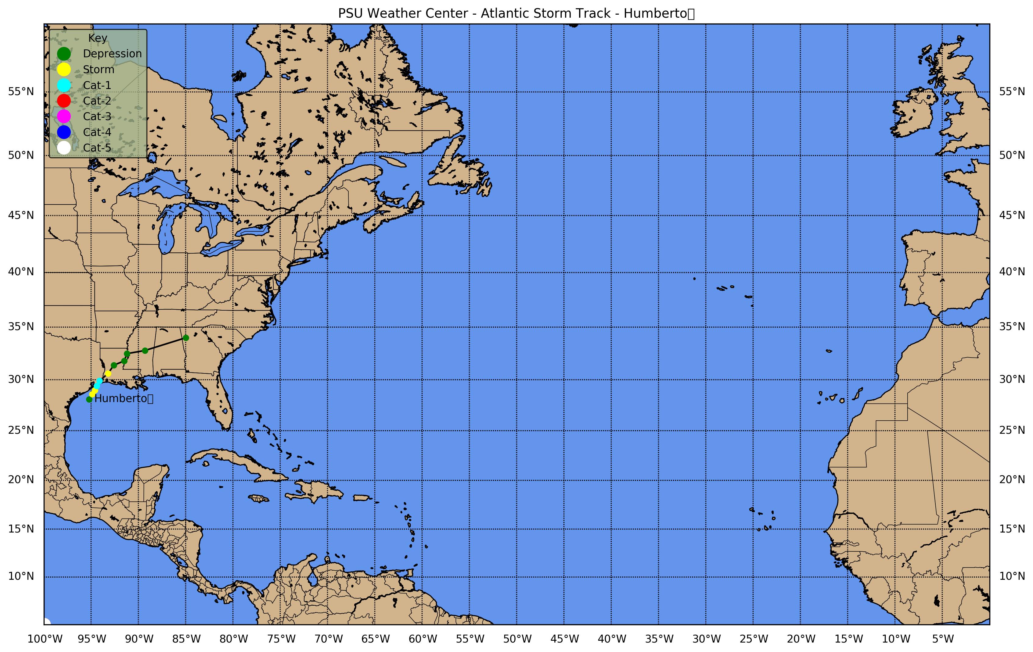
![[GIF]](atl_09_humberto07_plot.gif) Track Map
Track Map
 Large Satellite View
 Zoomed IR Satellite View
Radar:
![[GIF]](atl_09_humberto07_LCH_NTP.gif) Lake Charles (LCH) Storm Total Precipitation
Lake Charles (LCH) Storm Total Precipitation

![[GIF]](atl_10_ten07_plot.gif) Track Map
Track Map
 Large Satellite View
 Zoomed IR Satellite View
Radar:


![[GIF]](atl_11_jerry07_plot.gif) Track Map
Track Map
 Large Satellite View
 Zoomed IR Satellite View


![[GIF]](atl_12_karen07_plot.gif) Track Map
Track Map
 Large Satellite View
 Zoomed IR Satellite View


![[GIF]](atl_13_lorenzo07_plot.gif) Track Map
Track Map
 Large Satellite View
 Zoomed VIS Satellite View


![[GIF]](atl_14_melissa07_plot.gif) Track Map
Track Map
 Large Satellite View
 Zoomed IR Satellite View


![[GIF]](atl_15_fifteen07_plot.gif) Track Map
Track Map
 Large Satellite View
 Zoomed IR Satellite View

![[GIF]](atl_16_noel07_plot.gif) Track Map
Track Map
 Large Satellite View
 Zoomed IR Satellite View


![[GIF]](atl_17_olga07_plot.gif) Track Map
Track Map
 Large Satellite View
 Zoomed IR Satellite View