2015 Atlantic Hurricane Season Name List
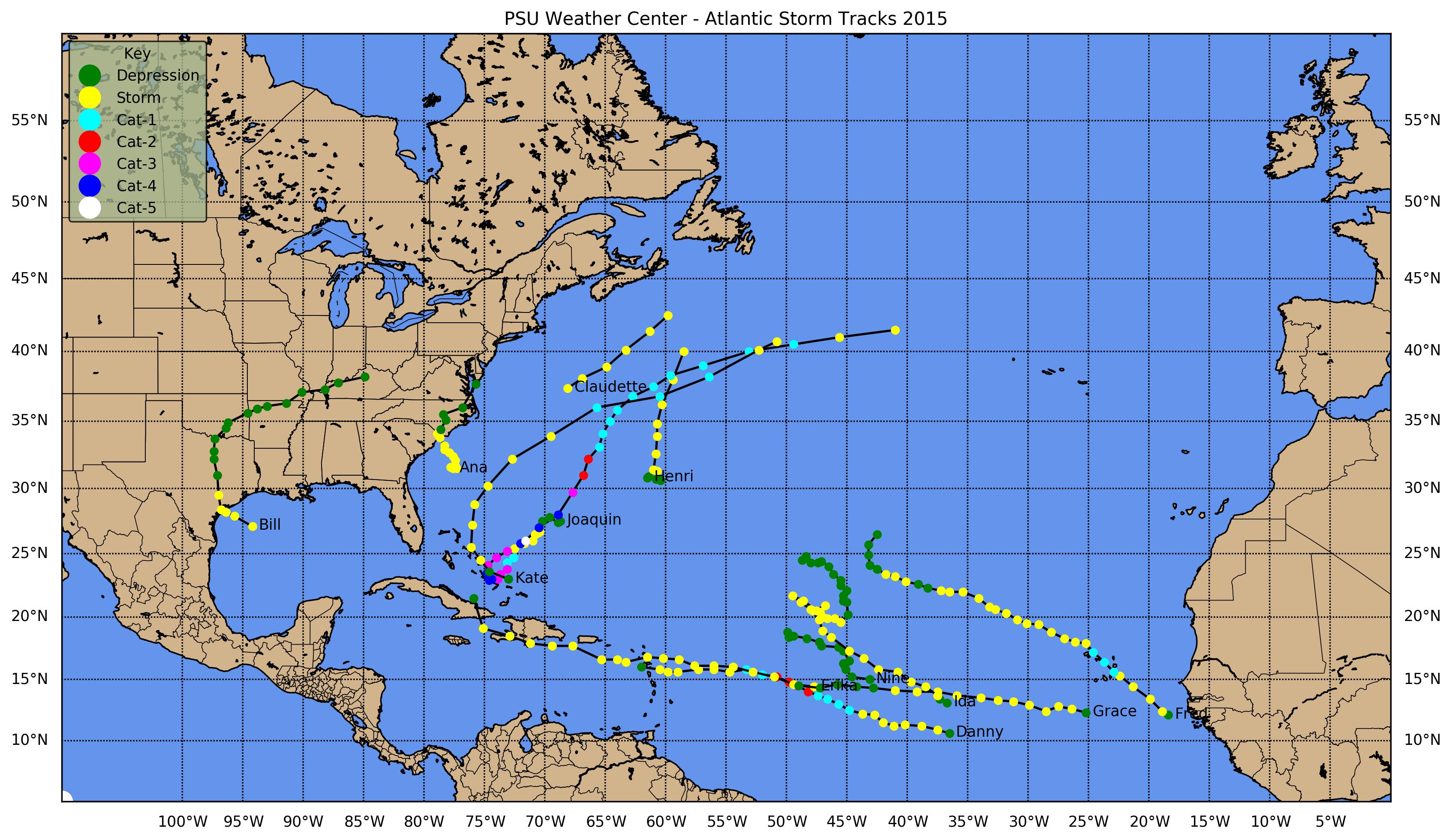

![[GIF]](atl_01_ana15_plot.gif) Track Map
Track Map
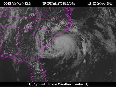
 Large Satellite View
 Zoomed IR Satellite View
Radar:
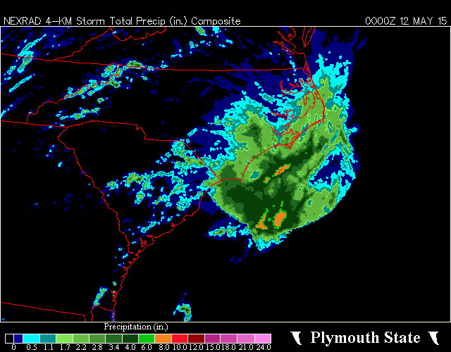 NEXRAD Composite Storm Total Precipitation
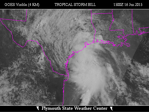

![[GIF]](atl_02_bill15_plot.gif) Track Map
Track Map
 Large Satellite View
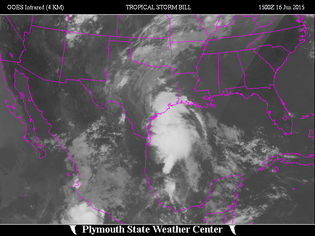
 Zoomed IR Satellite View
Radar:
 NEXRAD Composite Storm Total Precipitation

![[GIF]](atl_03_claudette15_plot.gif) Track Map
Track Map
 Large Satellite View
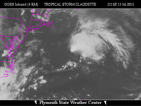 Zoomed IR Satellite View

![[GIF]](atl_04_danny15_plot.gif) Track Map
Track Map
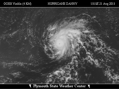
 Large Satellite View
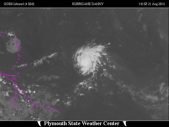
 Zoomed IR Satellite View


![[GIF]](atl_05_erika15_plot.gif) Track Map
Track Map
 Large Satellite View
 Zoomed IR Satellite View

![[GIF]](atl_06_fred15_plot.gif) Track Map
Track Map
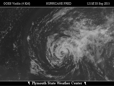
 Large Satellite View
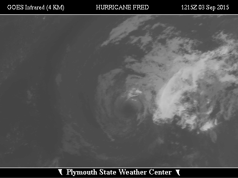 Zoomed IR Satellite View

![[GIF]](atl_07_grace15_plot.gif) Track Map
Track Map
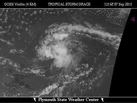
 Large Satellite View
 Zoomed IR Satellite View

![[GIF]](atl_08_henri15_plot.gif) Track Map
Track Map
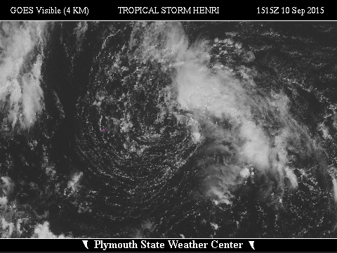
 Large Satellite View
 Zoomed IR Satellite View
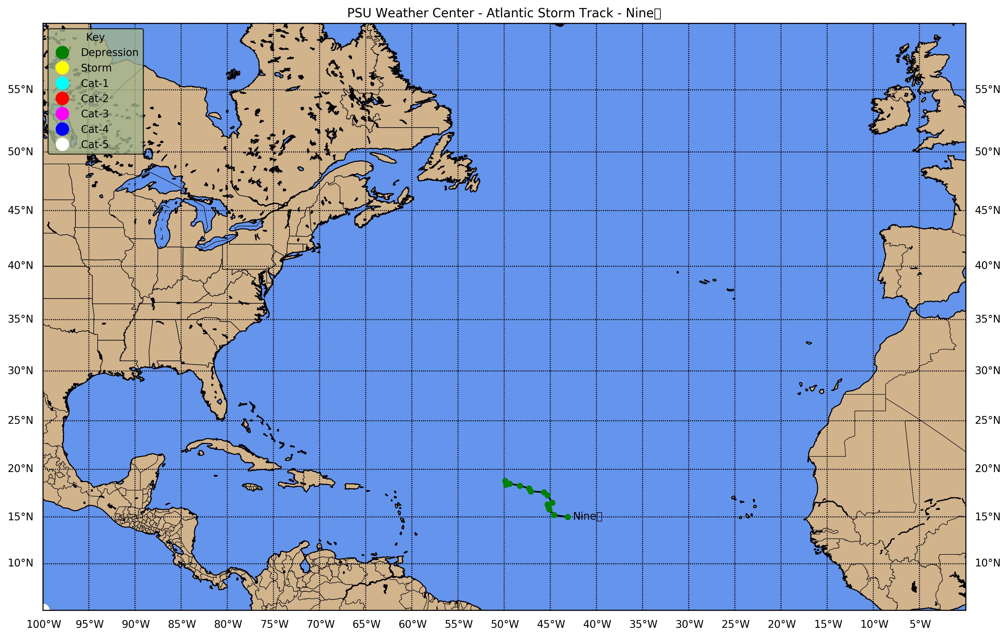
![[GIF]](atl_09_nine15_plot.gif) Track Map
Track Map
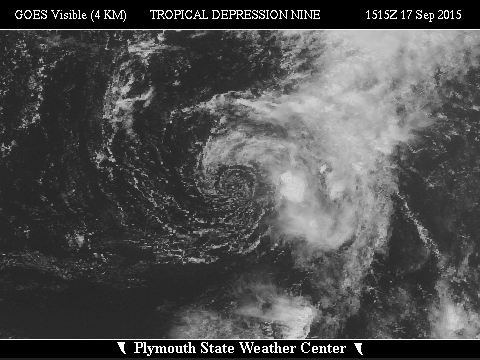
 Large Satellite View
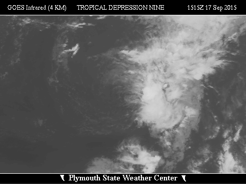 Zoomed IR Satellite View


![[GIF]](atl_10_ida15_plot.gif) Track Map
Track Map
 Large Satellite View
 Zoomed IR Satellite View


![[GIF]](atl_11_joaquin15_plot.gif) Track Map
Track Map
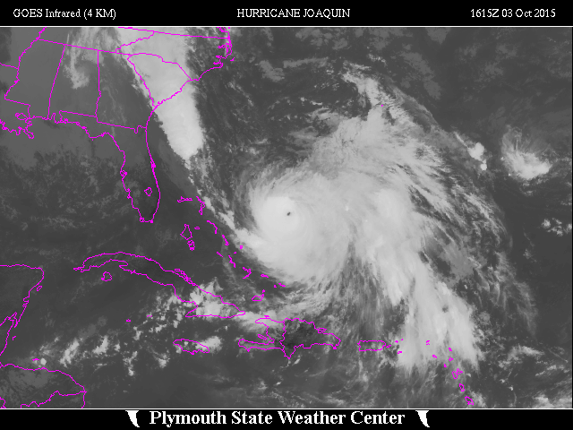 Large Satellite View
 Zoomed IR Satellite View
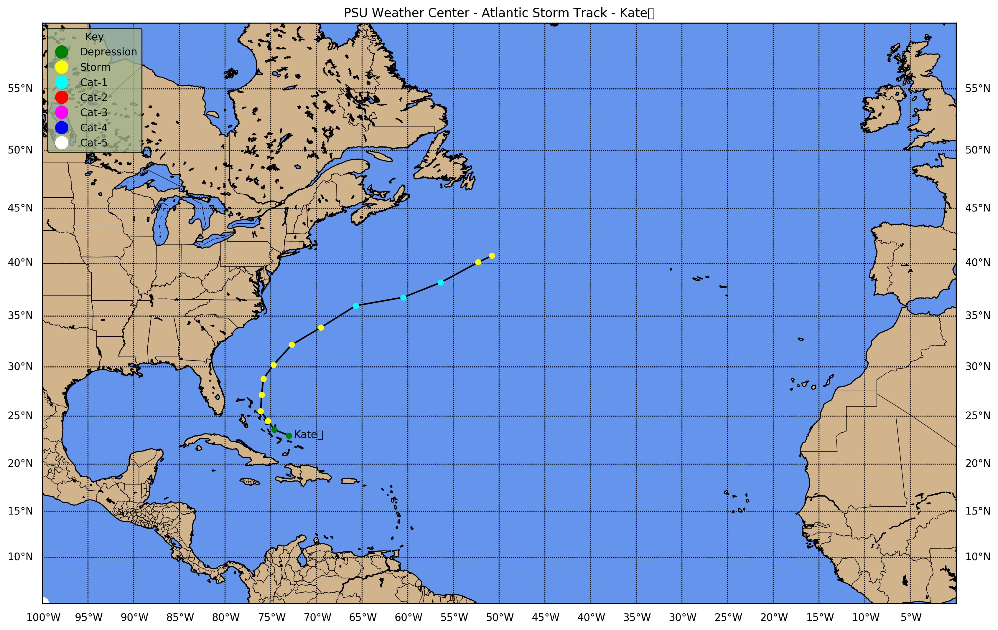
![[GIF]](atl_12_kate15_plot.gif) Track Map
Track Map
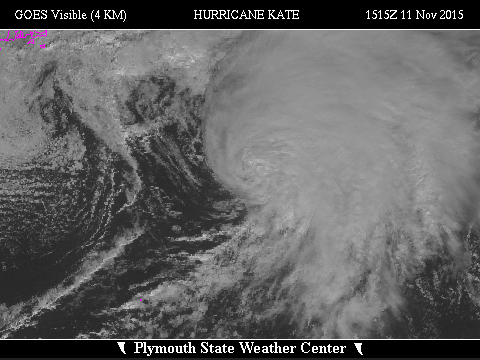
 Large Satellite View
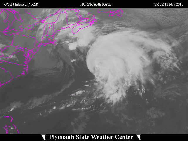
 Zoomed IR Satellite View