2018 Atlantic Hurricane Season Name List

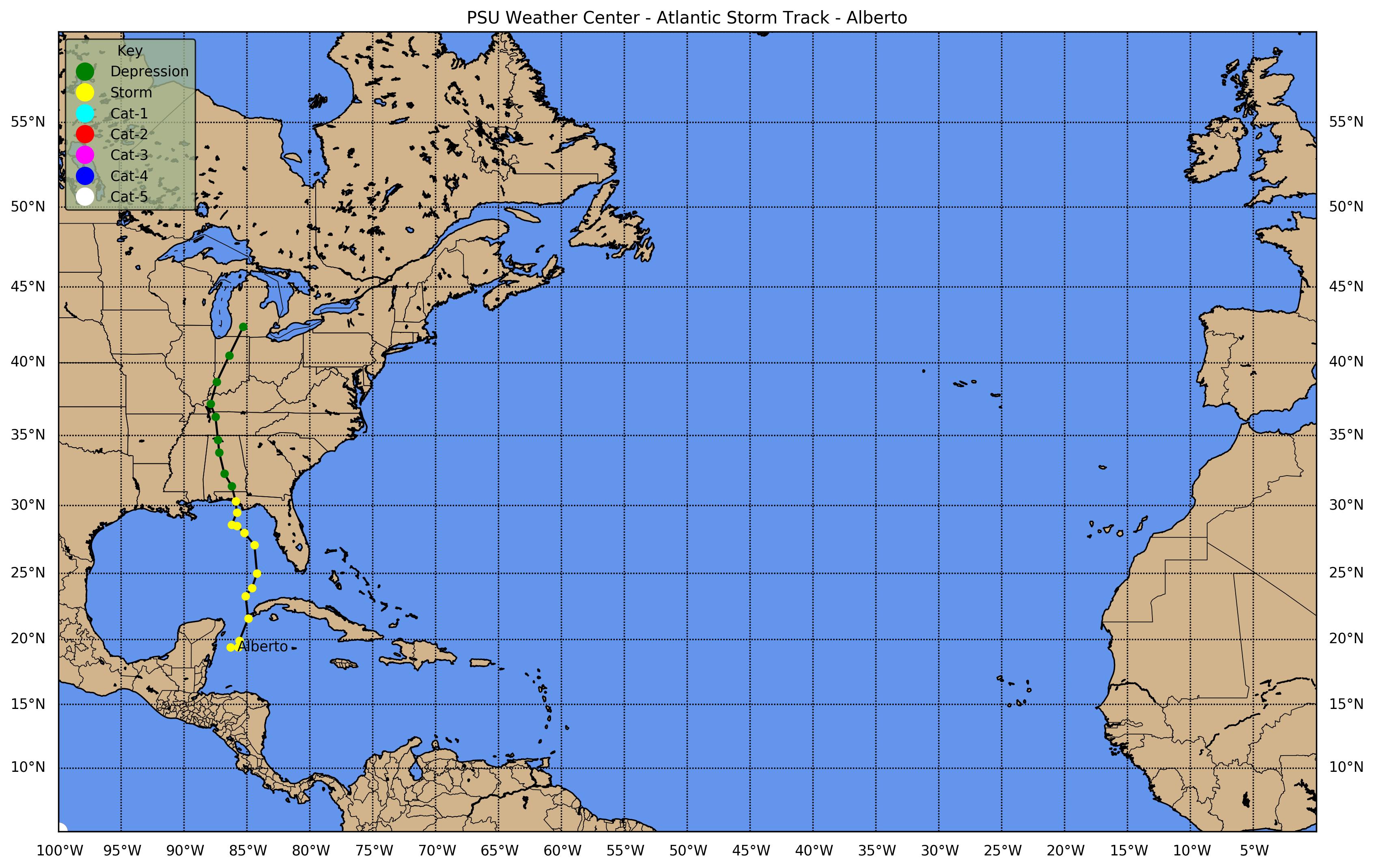
![[GIF]](atl_01_alberto18_plot.gif) Track Map
Track Map
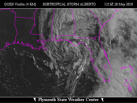
 Large Satellite View
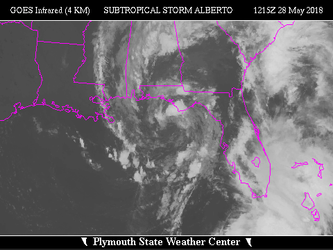 Zoomed IR Satellite View

![[GIF]](atl_02_beryl18_plot.gif) Track Map
Track Map
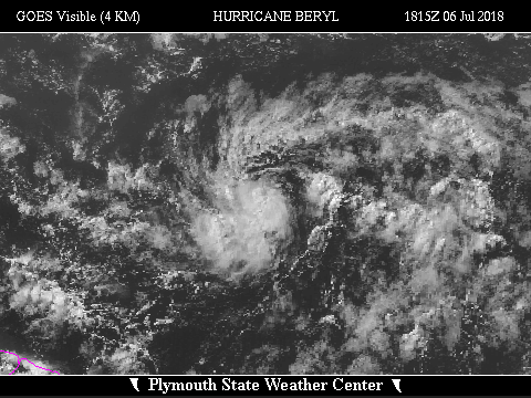
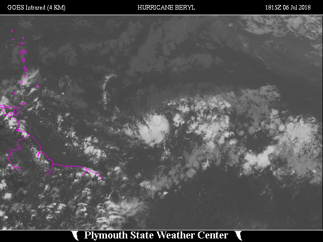 Large Satellite View
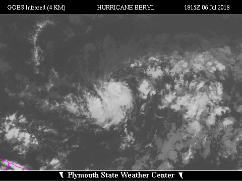 Zoomed IR Satellite View


![[GIF]](atl_03_chris18_plot.gif) Track Map
Track Map
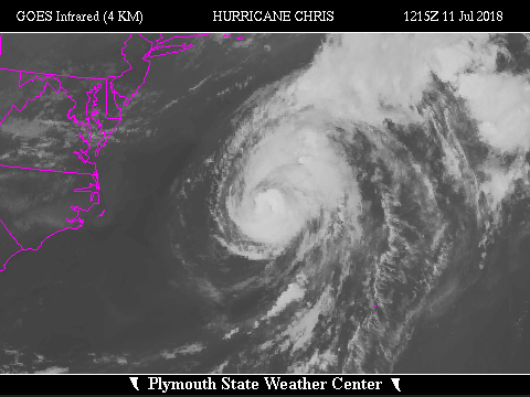
 Large Satellite View
 Zoomed IR Satellite View

![[GIF]](atl_04_debby18_plot.gif) Track Map
Track Map
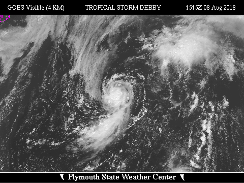
 Large Satellite View
 Zoomed IR Satellite View


![[GIF]](atl_05_ernesto18_plot.gif) Track Map
Track Map
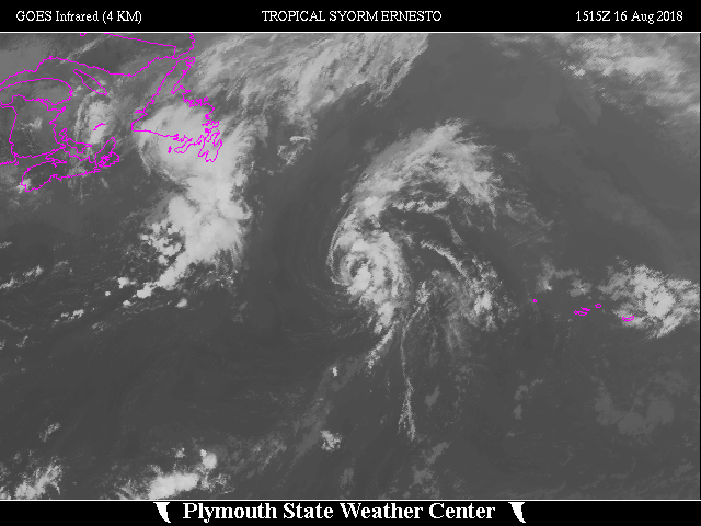 Large Satellite View
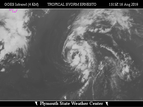 Zoomed IR Satellite View

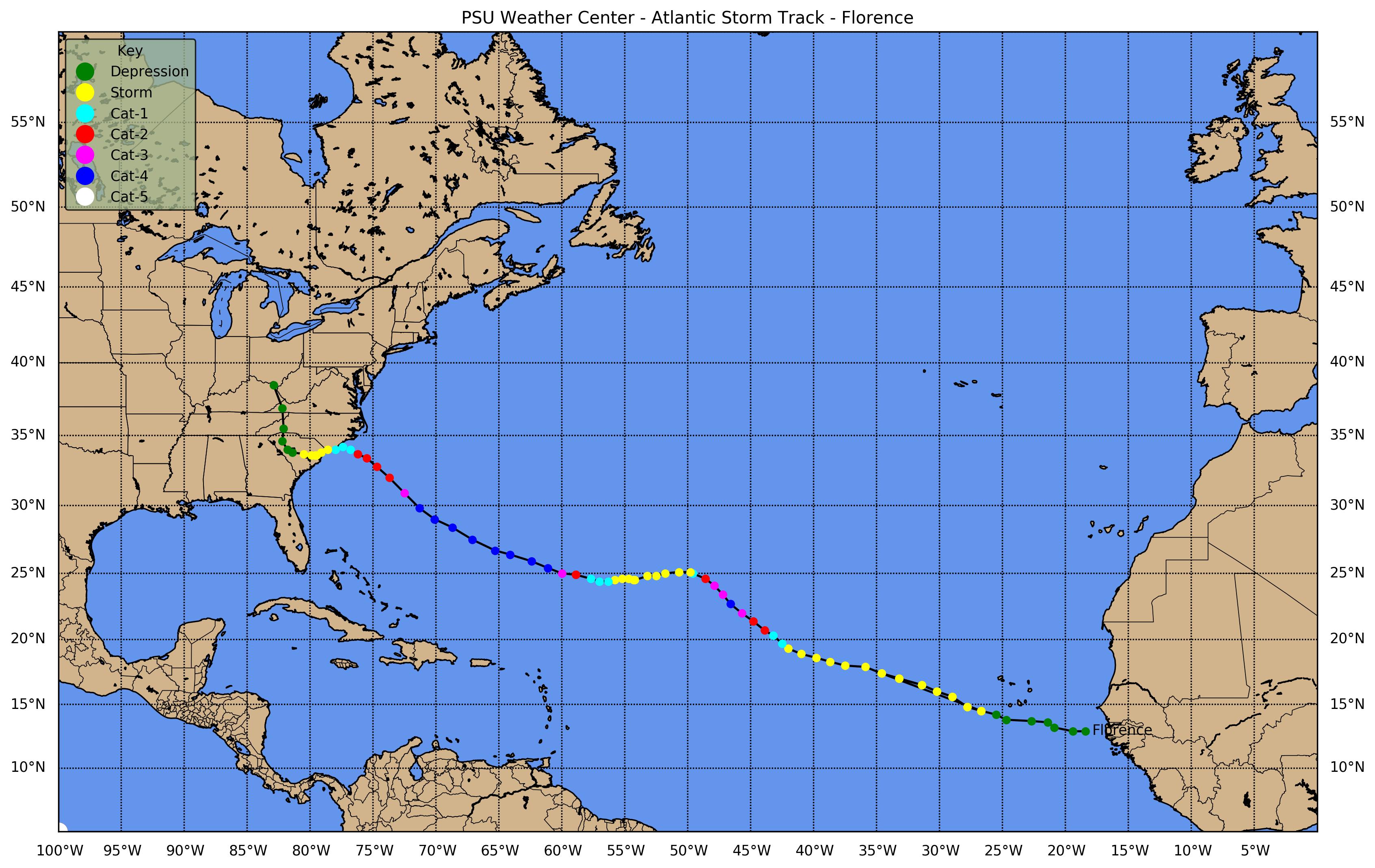
![[GIF]](atl_06_florence18_plot.gif) Track Map
Track Map
 Large Satellite View
 Zoomed IR Satellite View
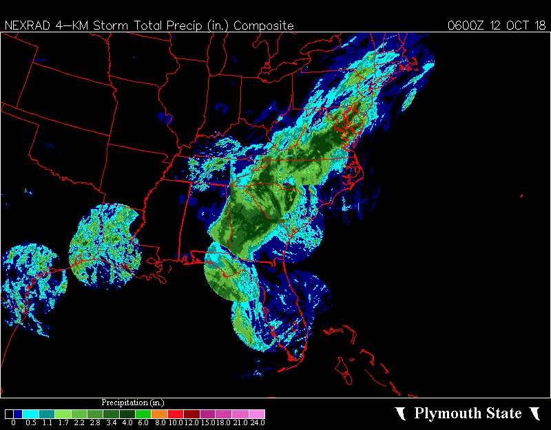
Composite Radar: Base Reflectivity Loop ... Storm Total Precipitation Loop ... Storm Total Precipitation
Base Radial Velocity Loops: Morehead City, NC (MHX) ... Wilmington, NC (LTX) (Note: MHX radar went down on 15 Sep 2018 at 1918Z)
Precipitation & Peak Wind Summary: WPC

![[GIF]](atl_07_gordon18_plot.gif) Track Map
Track Map
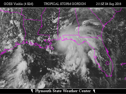
 Large Satellite View
 Zoomed IR Satellite View


![[GIF]](atl_08_helene18_plot.gif) Track Map
Track Map
 Large Satellite View
 Zoomed IR Satellite View
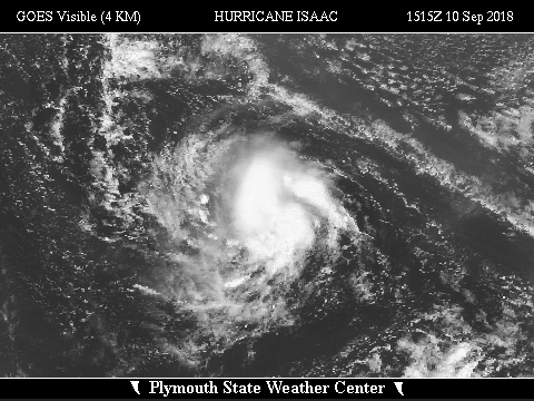

![[GIF]](atl_09_isaac18_plot.gif) Track Map
Track Map
 Large Satellite View
 Zoomed IR Satellite View


![[GIF]](atl_10_joyce18_plot.gif) Track Map
Track Map
 Large Satellite View
 Zoomed IR Satellite View
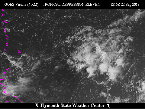

![[GIF]](atl_11_eleven18_plot.gif) Track Map
Track Map
 Large Satellite View
 Zoomed IR Satellite View
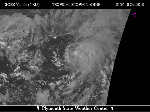

![[GIF]](atl_15_nadine18_plot.gif) Track Map
Track Map
 Large Satellite View
 Zoomed IR Satellite View
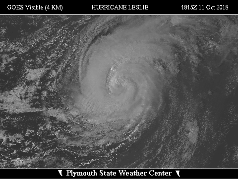

![[GIF]](atl_13_leslie18_plot.gif) Track Map
Track Map
 Large Satellite View
 Zoomed IR Satellite View


![[GIF]](atl_14_michael18_plot.gif) Track Map
Track Map
 Large Satellite View
 Zoomed IR Satellite View
Composite Radar: Base Reflectivity Loop ... Storm Total Precipitation
Red Bay/Eglin AFB, FL (EVX) Loops: Base Reflectivity ... Base Radial Velocity
Tallahassee, FL (TLH) Loops: Base Reflectivity ... Base Radial Velocity
(Note: TLH radar went down on 10 Oct 2018 shortly after 1642Z)
Track Map
Large Satellite View
Zoomed IR Satellite View


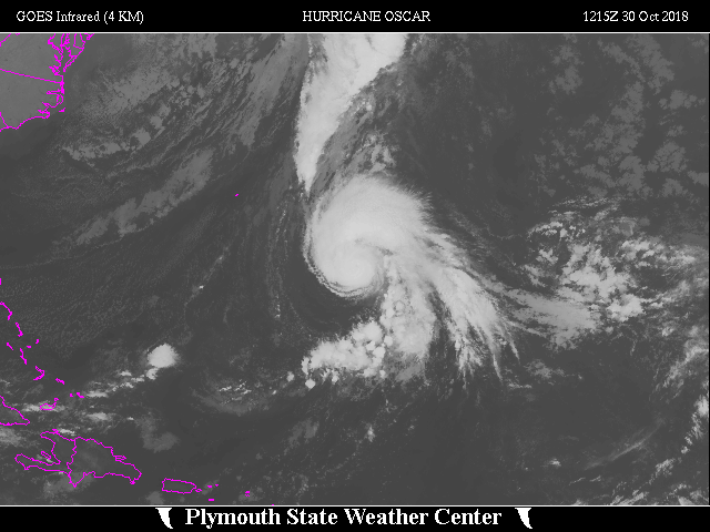
![[GIF]](atl_16_oscar18_plot.gif) Track Map
Track Map
 Large Satellite View
 Zoomed IR Satellite View