2020 Atlantic Hurricane Season Name List


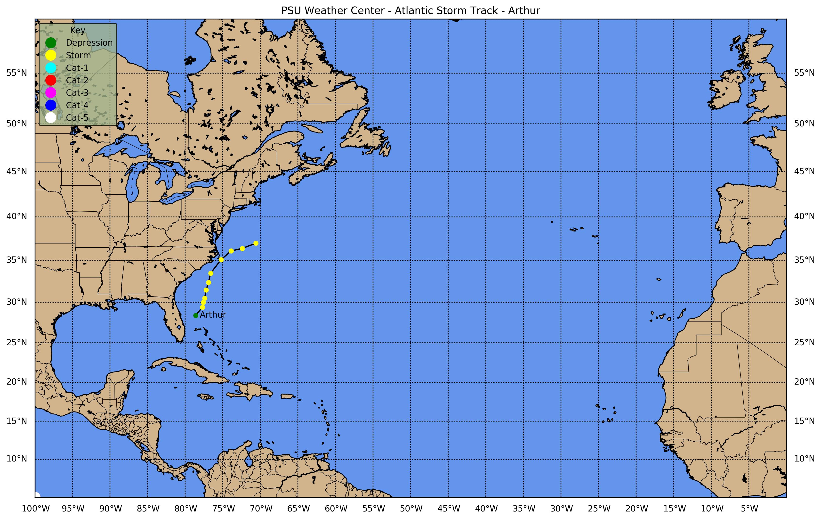
![[GIF]](atl_01_arthur20_plot.gif) Track Map
Track Map
 Large Satellite View
 Zoomed IR Satellite View


![[GIF]](atl_02_bertha20_plot.gif) Track Map
Track Map
 Large Satellite View
 Zoomed IR Satellite View
Radar: Composite Reflectivity Loop ... Composite Storm Total Preciptation ... LTX Base Radial Velocity Loop


![[GIF]](atl_03_cristobal20_plot.gif) Track Map
Track Map
 Large Satellite View
 Zoomed IR Satellite View
Radar: Composite Reflectivity Loop ... Composite Storm Total Preciptation ... LIX Base Radial Velocity Loop


![[GIF]](atl_04_dolly20_plot.gif) Track Map
Track Map
 Large Satellite View
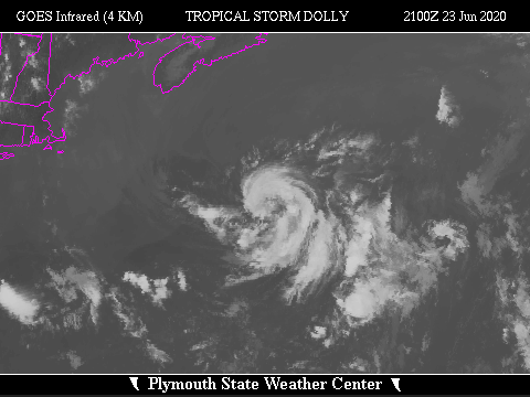 Zoomed IR Satellite View


![[GIF]](atl_05_edouard20_plot.gif) Track Map
Track Map
 Large Satellite View
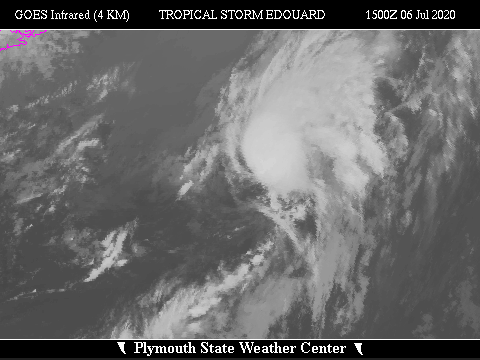 Zoomed IR Satellite View


![[GIF]](atl_06_fay20_plot.gif) Track Map
Track Map
 Large Satellite View
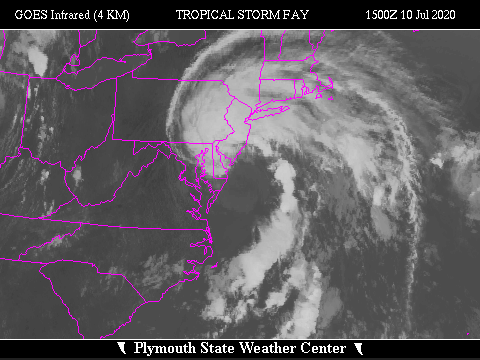 Zoomed IR Satellite View
Radar: Composite Reflectivity Loop ... Composite Storm Total Preciptation ... DIX Base Radial Velocity Loop


![[GIF]](atl_07_gonzalo20_plot.gif) Track Map
Track Map
 Large Satellite View
 Zoomed IR Satellite View


![[GIF]](atl_08_hanna20_plot.gif) Track Map
Track Map
 Large Satellite View
 Zoomed IR Satellite View
Radar Composites: Reflectivity Loop ... Storm Total Preciptation
Corpus Christi, TX (CRP) Radar: Base Reflectivity Loop ... Base Radial Velocity Loop ... Storm Total Precipitation
Brownsville, TX (BRO) Radar: Base Reflectivity Loop ... Base Radial Velocity Loop ... Storm Total Precipitation
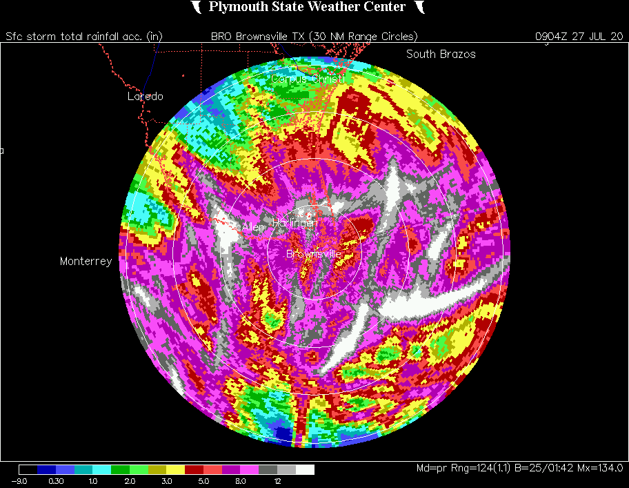


![[GIF]](atl_09_isaias20_plot.gif) Track Map
Track Map
 Large Satellite View
 Zoomed IR Satellite View
Radar Composites: Reflectivity Loop ... Storm Total Preciptation
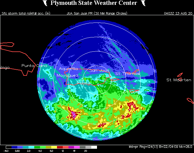
San Juan (JUA) Radar: Base Reflectivity Loop ... Base Radial Velocity Loop ... Storm Total Precipitation
Charleston, SC (CLX) Radar: Base Reflectivity Loop ... Base Radial Velocity Loop ... Storm Total Precipitation
Shallotte/Wilmington, NC (LTX) Radar: Base Reflectivity Loop ... Base Radial Velocity Loop ... Storm Total Precipitation
Newport/Morehead City, NC (MHX) Radar: Base Reflectivity Loop ... Base Radial Velocity Loop ... Storm Total Precipitation


![[GIF]](atl_10_ten20_plot.gif) Track Map
Track Map
 Large Satellite View
 Zoomed IR Satellite View


![[GIF]](atl_11_josephine20_plot.gif) Track Map
Track Map
 Large Satellite View
 Zoomed IR Satellite View


![[GIF]](atl_12_kyle20_plot.gif) Track Map
Track Map
 Large Satellite View
 Zoomed IR Satellite View


![[GIF]](atl_13_laura20_plot.gif) Track Map
Track Map
 Large Satellite View
 Zoomed IR Satellite View
Radar Composites: Reflectivity Loop ... Storm Total Preciptation
San Juan (JUA) Radar: Base Reflectivity Loop ... Base Radial Velocity Loop ... Storm Total Precipitation
Base Radial Velocity Loops: Lake Charles, LA ... Fort Polk, LA ... Shreveport, LA ... Little Rock, AR


![[GIF]](atl_14_marco20_plot.gif) Track Map
Track Map
 Large Satellite View
 Zoomed IR Satellite View
Radar Composites: Reflectivity Loop ... Storm Total Preciptation


![[GIF]](atl_15_omar20_plot.gif) Track Map
Track Map
 Large Satellite View
 Zoomed IR Satellite View


![[GIF]](atl_16_nana20_plot.gif) Track Map
Track Map
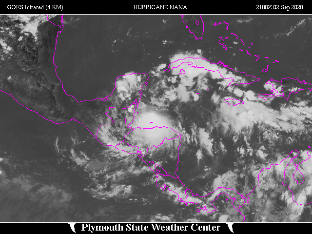 Large Satellite View
 Zoomed IR Satellite View


![[GIF]](atl_17_paulette20_plot.gif) Track Map
Track Map
 Large Satellite View
 Zoomed IR Satellite View


![[GIF]](atl_18_rene20_plot.gif) Track Map
Track Map
 Large Satellite View
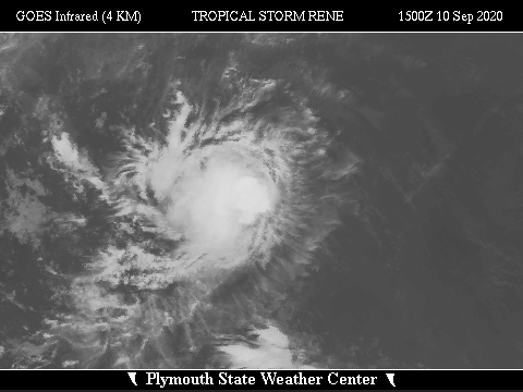 Zoomed IR Satellite View


![[GIF]](atl_19_sally20_plot.gif) Track Map
Track Map
 Large Satellite View
 Zoomed IR Satellite View
Radar Composites: Reflectivity Loop ... Storm Total Preciptation
Base Radial Velocity Loops: Mobile, AL ... Red Bay/Eglin AFB, FL


![[GIF]](atl_20_teddy20_plot.gif) Track Map
Track Map
 Large Satellite View
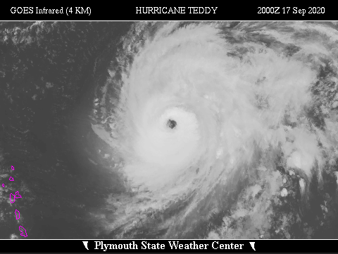 Zoomed IR Satellite View


![[GIF]](atl_21_vicky20_plot.gif) Track Map
Track Map
 Large Satellite View
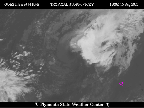 Zoomed IR Satellite View


![[GIF]](atl_22_beta20_plot.gif) Track Map
Track Map
 Large Satellite View
 Zoomed IR Satellite View
Radar Composites: Reflectivity Loop ... Storm Total Preciptation


![[GIF]](atl_23_wilfred20_plot.gif) Track Map
Track Map
 Large Satellite View
 Zoomed IR Satellite View


 Large Satellite View
 Zoomed IR Satellite View


![[GIF]](atl_25_gamma20_plot.gif) Track Map
Track Map
 Large Satellite View
 Zoomed IR Satellite View

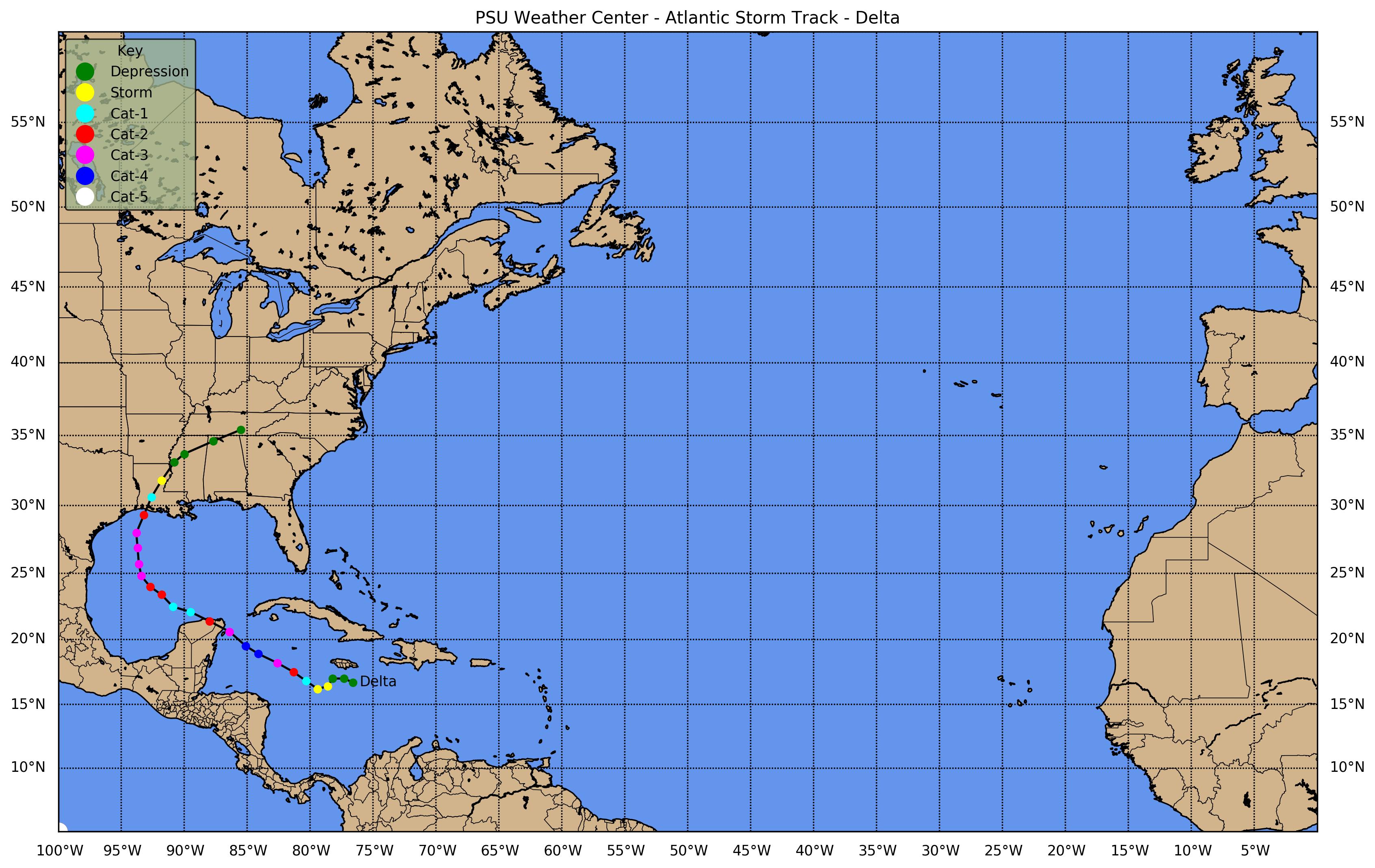
![[GIF]](atl_26_delta20_plot.gif) Track Map
Track Map
 Large Satellite View
 Zoomed IR Satellite View
Radar Composites: Reflectivity Loop ... Storm Total Preciptation
Base Radial Velocity Loops: League City/Houston, TX ... Fort Polk, LA


![[GIF]](atl_27_epsilon20_plot.gif) Track Map
Track Map
 Large Satellite View
 Zoomed IR Satellite View


![[GIF]](atl_28_zeta20_plot.gif) Track Map
Track Map
 Large Satellite View
 Zoomed IR Satellite View


![[GIF]](atl_29_eta20_plot.gif) Track Map
Track Map
 Large Satellite View
 Zoomed IR Satellite View
Radar Composites: Reflectivity Loop ... Storm Total Preciptation
Base Radial Velocity Loops: Ruskin/Tampa Bay


![[GIF]](atl_30_theta20_plot.gif) Track Map
Track Map
 Large Satellite View
 Zoomed IR Satellite View


![[GIF]](atl_31_iota20_plot.gif) Track Map
Track Map
 Large Satellite View
 Zoomed IR Satellite View