2005 Atlantic Hurricane Season Name List

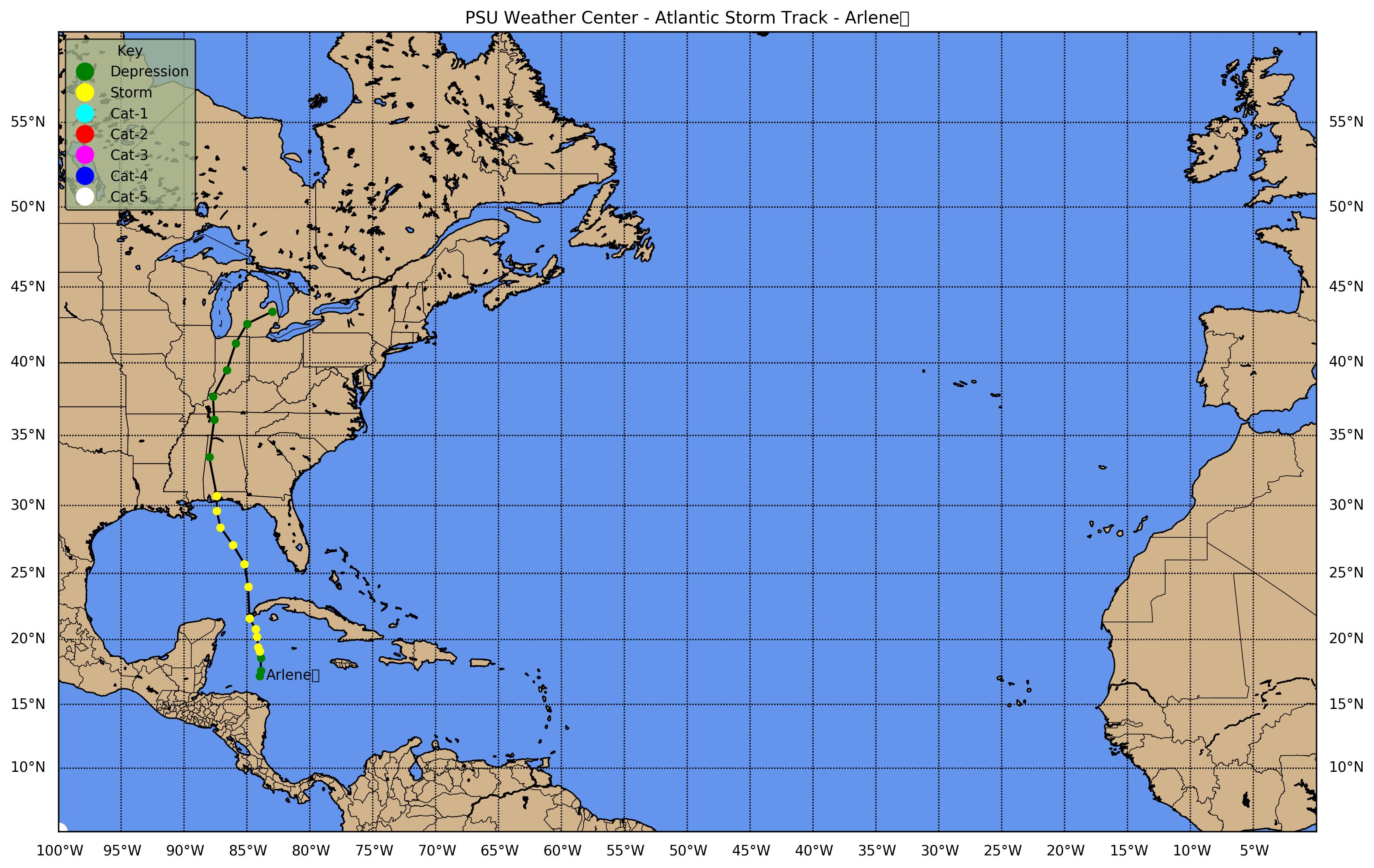
Tropical Storm Arlene (Jun 8-13)
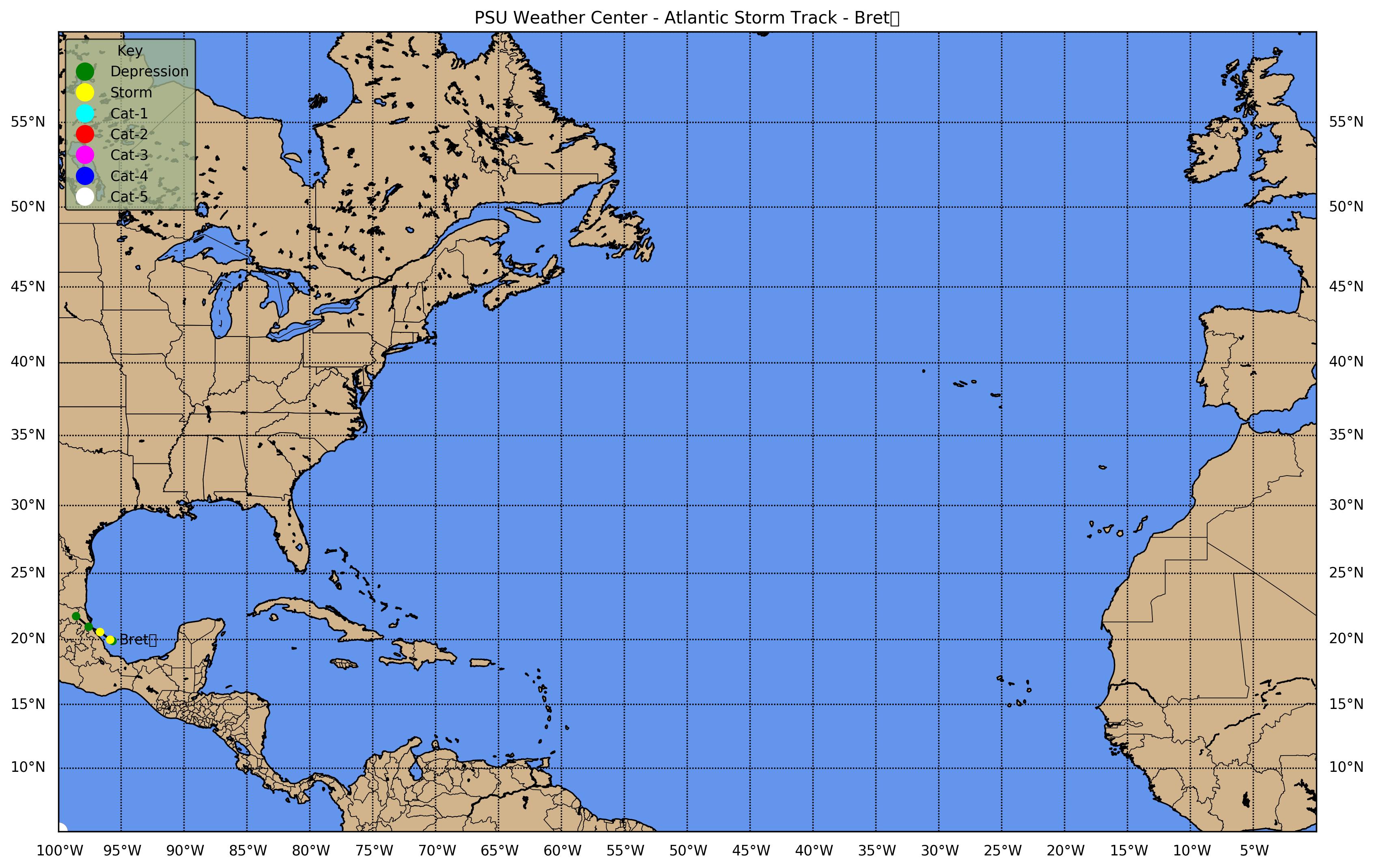
Tropical Storm Bret (Jun 28-30)
Tropical Storm Cindy (Jul 3-8)
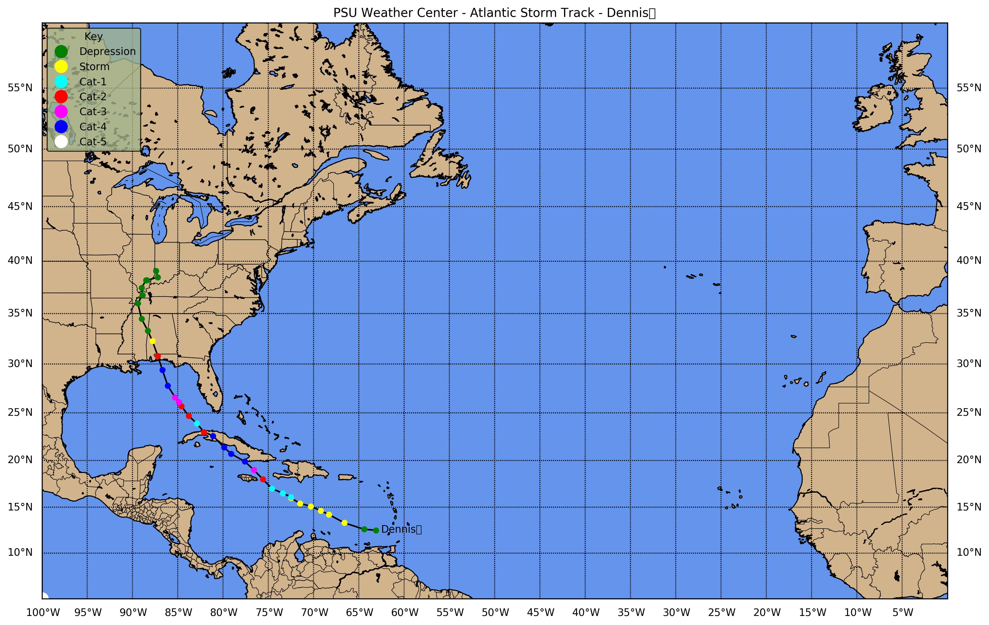
Hurricane Dennis (Jul 5-13)
Hurricane Emily (Jul 11-21)
Tropical Storm Franklin (Jul 21-29)
Tropical Storm Gert (Jul 23-25)
Tropical Storm Harvey (Aug 2-8)
Hurricane Irene (Aug 4-18)
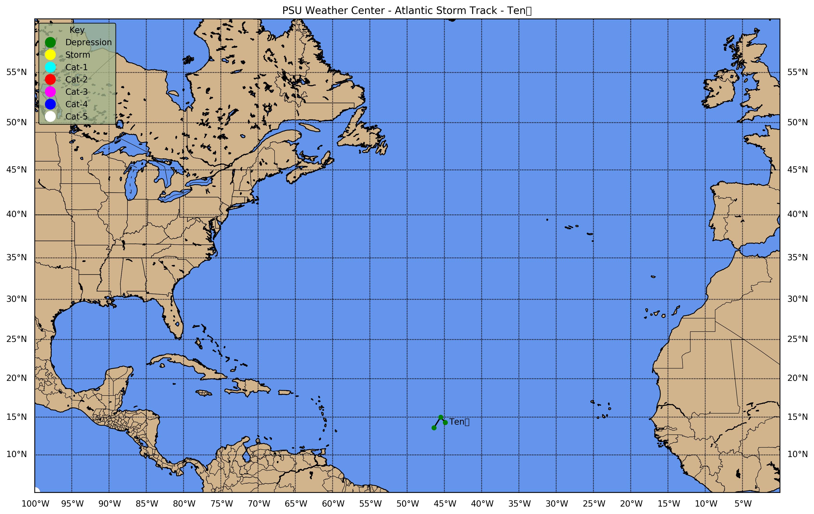
Tropical Depression 10 (Aug 13-14)
Tropical Storm Jose (Aug 22-23)
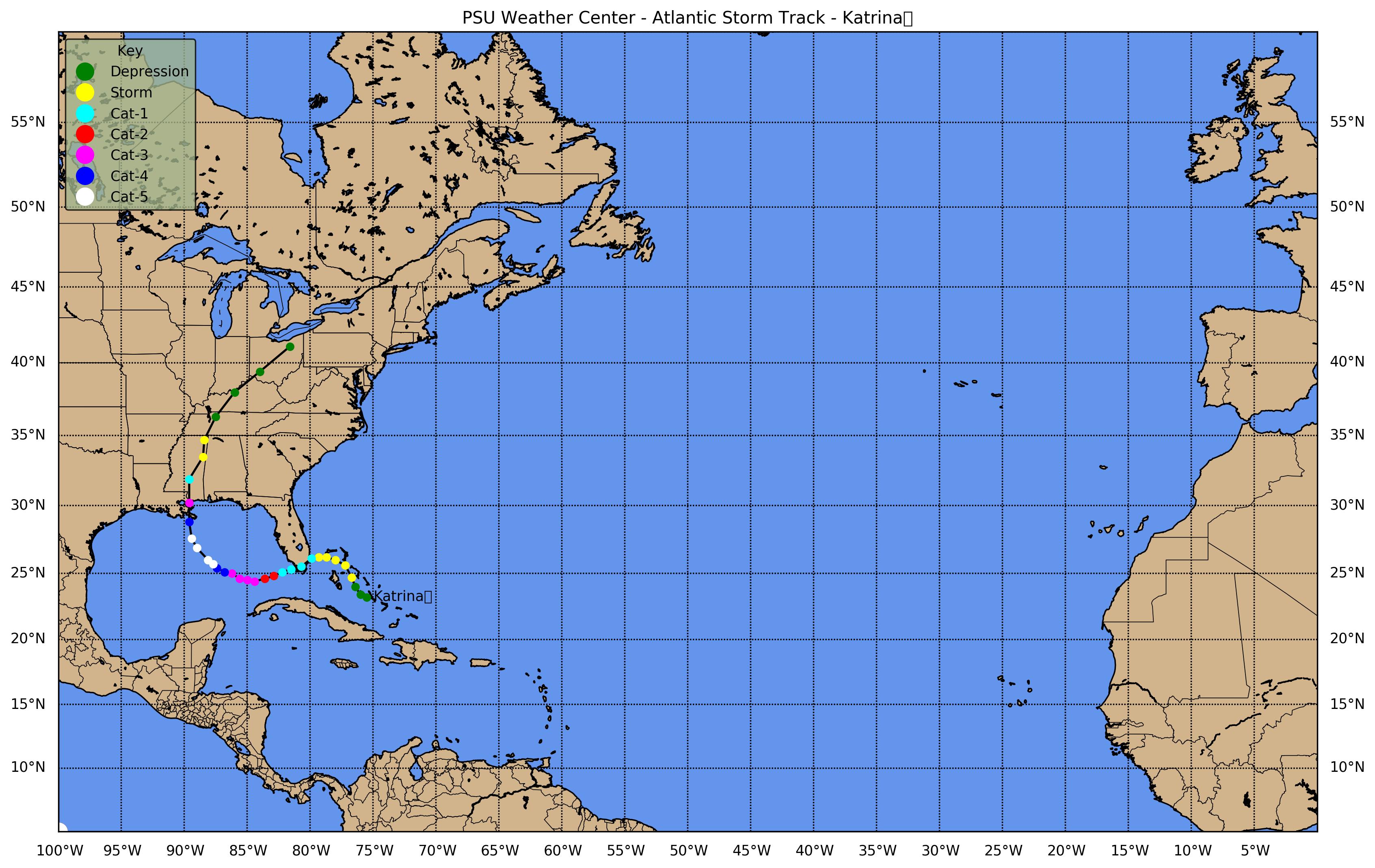
Hurricane Katrina (Aug 23-31)
Tropical Depression 13 (Aug 28-29)
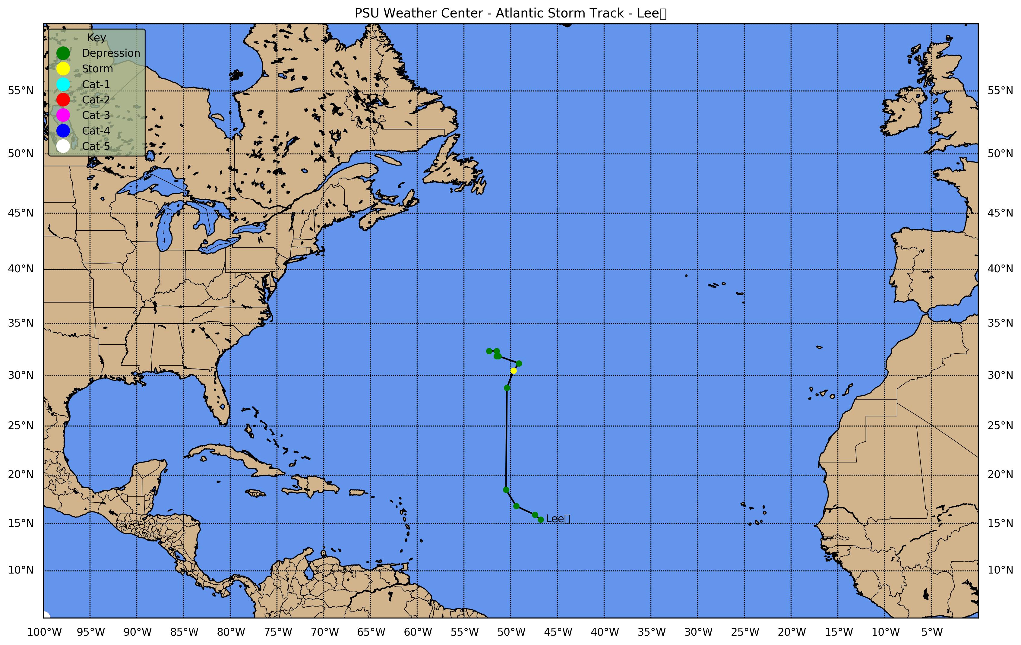
Tropical Storm Lee (Aug 31 - Sep 2)
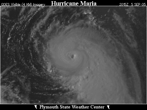
Hurricane Maria (Sep 1-10)
Hurricane Nate (Sep 5-10)
Hurricane Ophelia (Sep 6-18)
Hurricane Philippe (Sep 17-24)
Hurricane Rita (Sep 18-26)
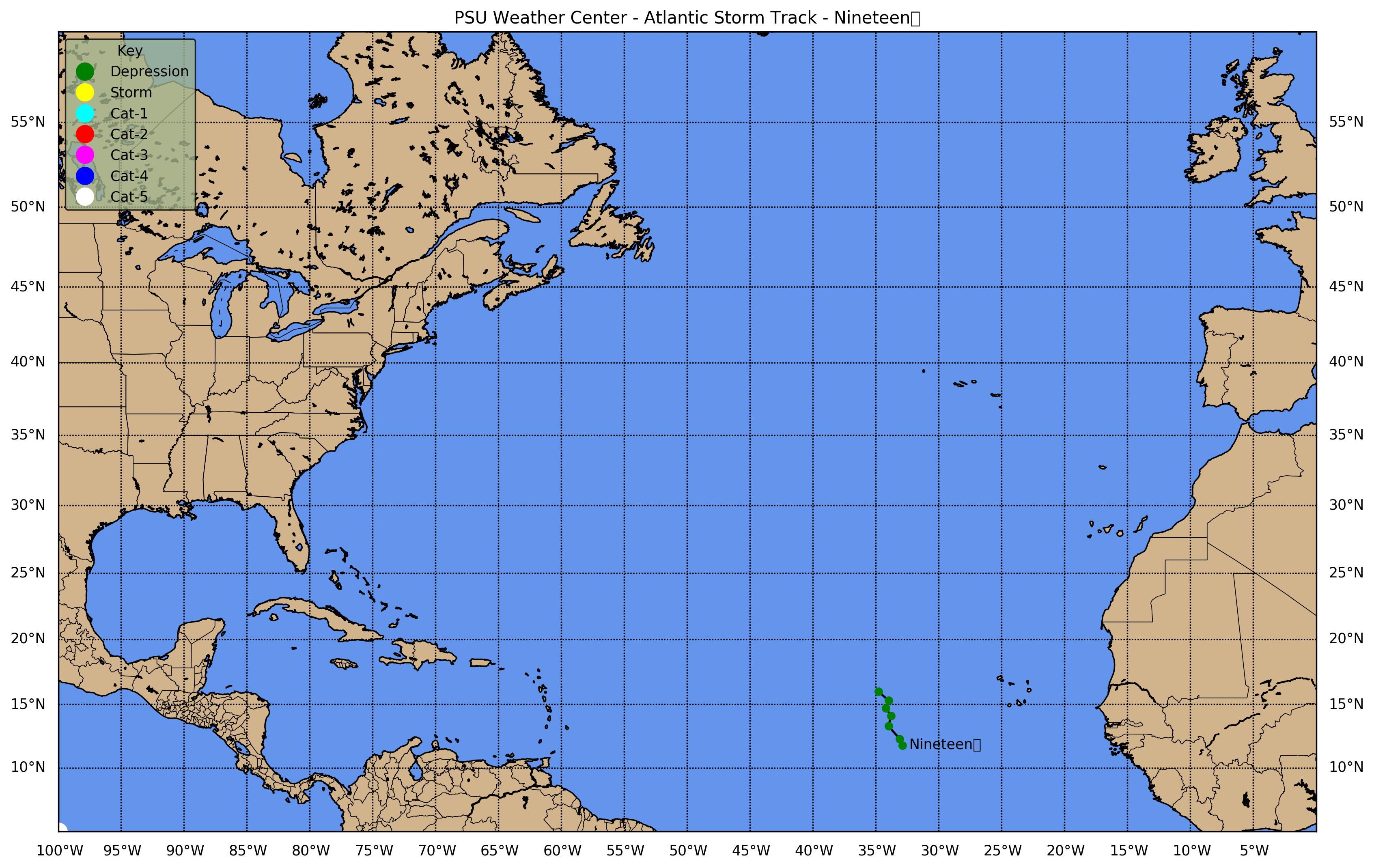
Tropical Depression 19 (Sep 30 - Oct 2)
Hurricane Stan (Oct 1-5)
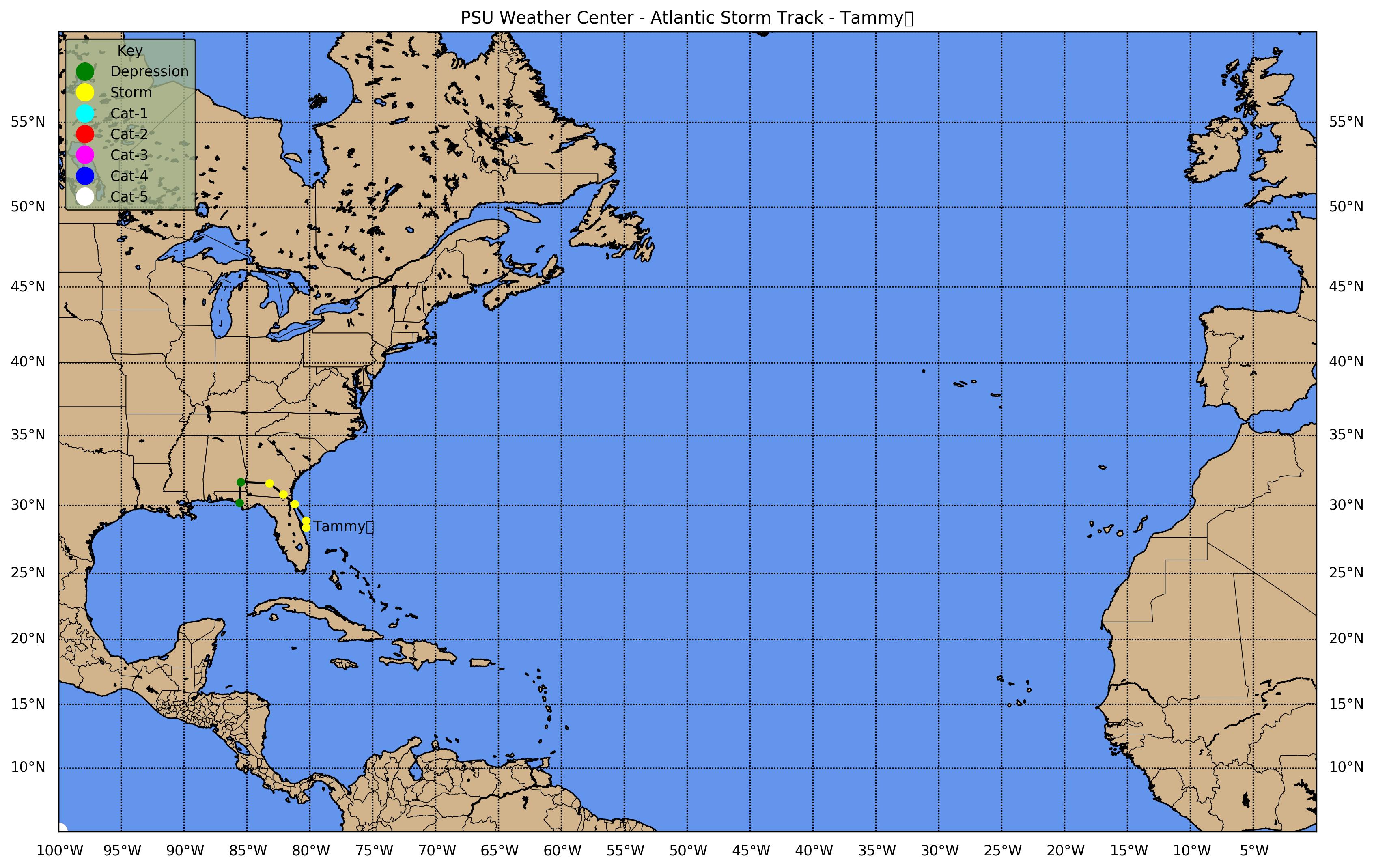
Tropical Storm Tammy (Oct 5-6)
Subtropical Depression 22 (Oct 8-9)
Hurricane Vicne (Oct 9-11)
Hurricane Wilma (Oct 15-25)
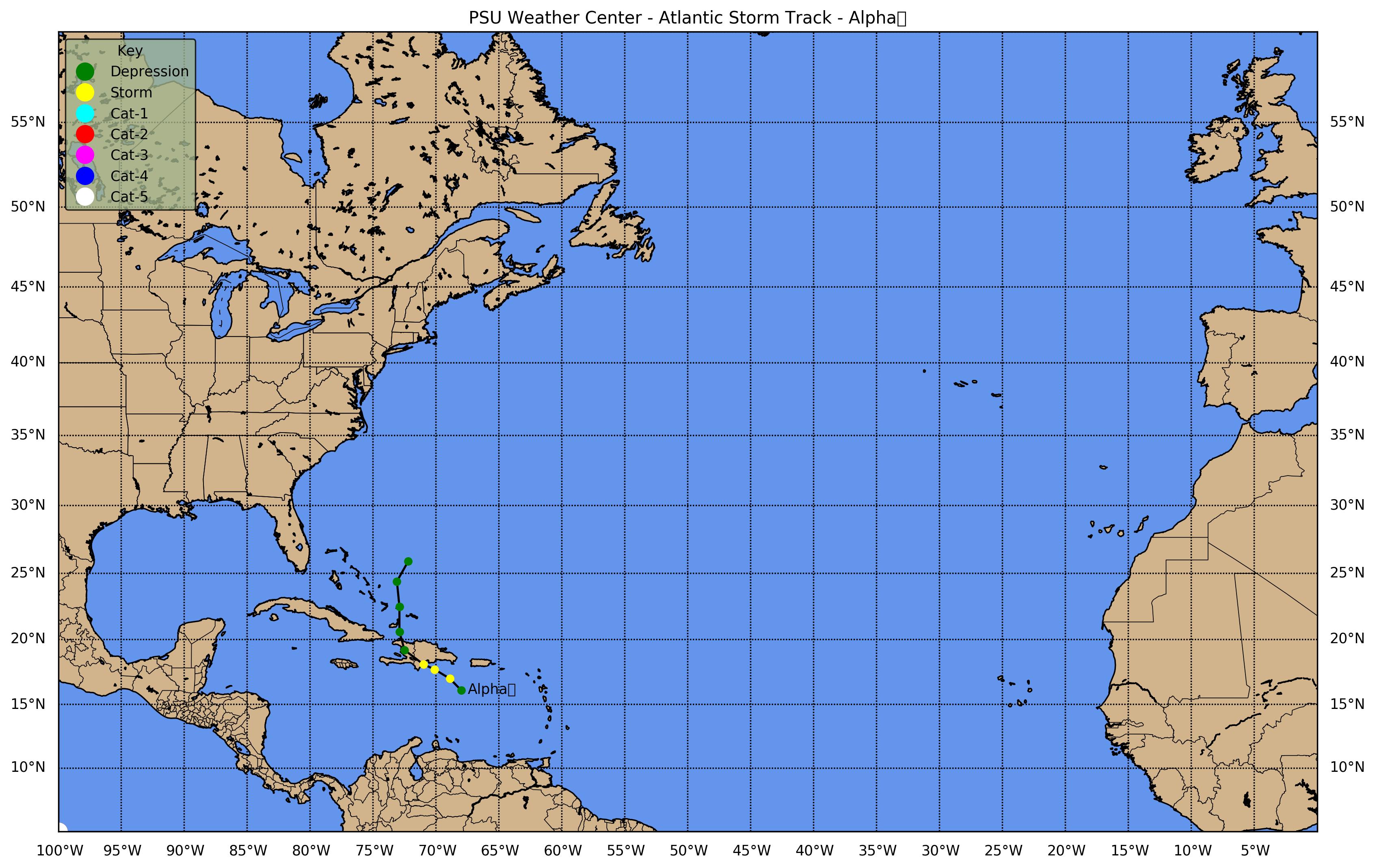
Tropical Storm Alpha (Oct 22-24)
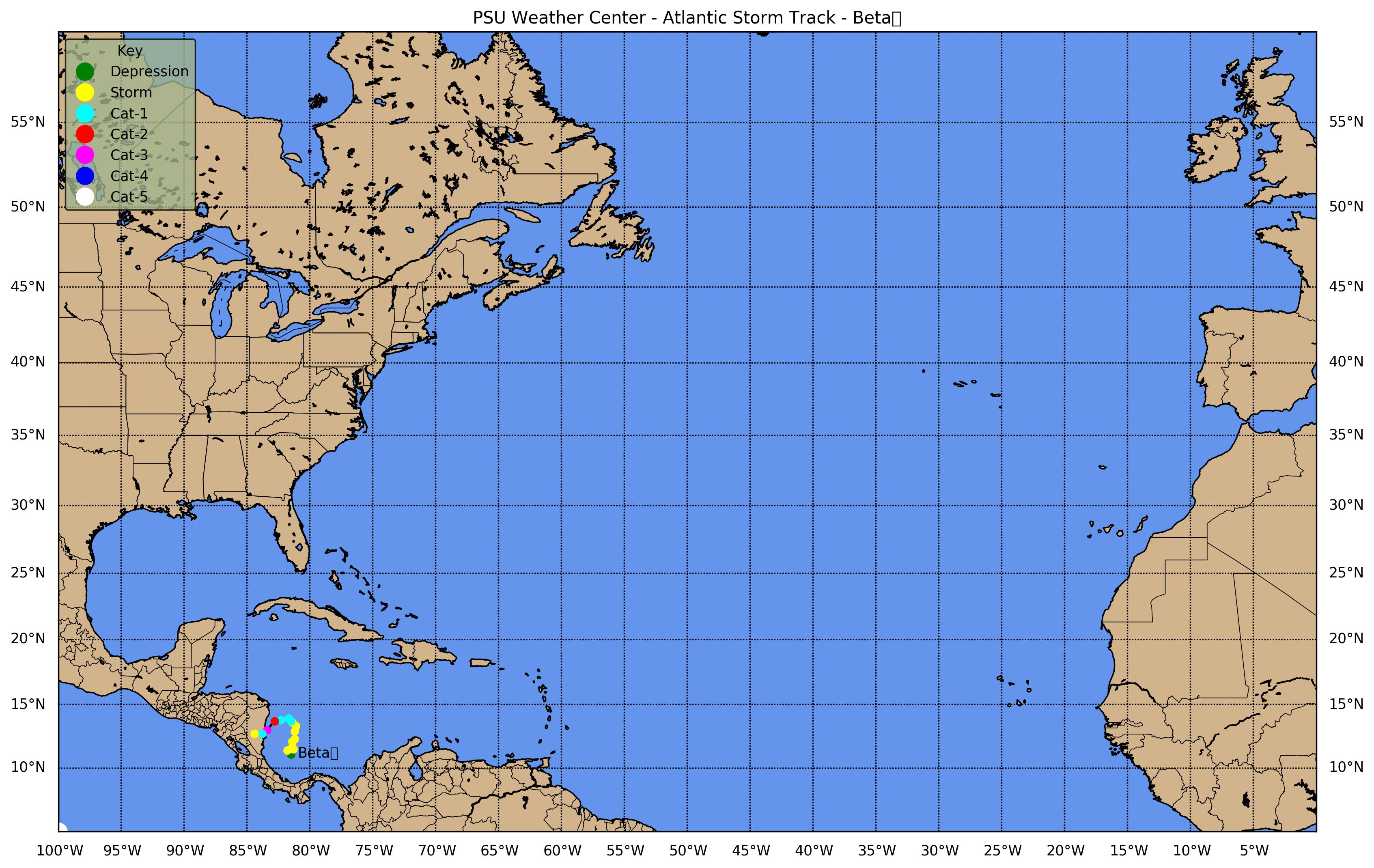
Hurricane Beta (Oct 27-31)
Tropical Depression 27 (Nov 14-16)
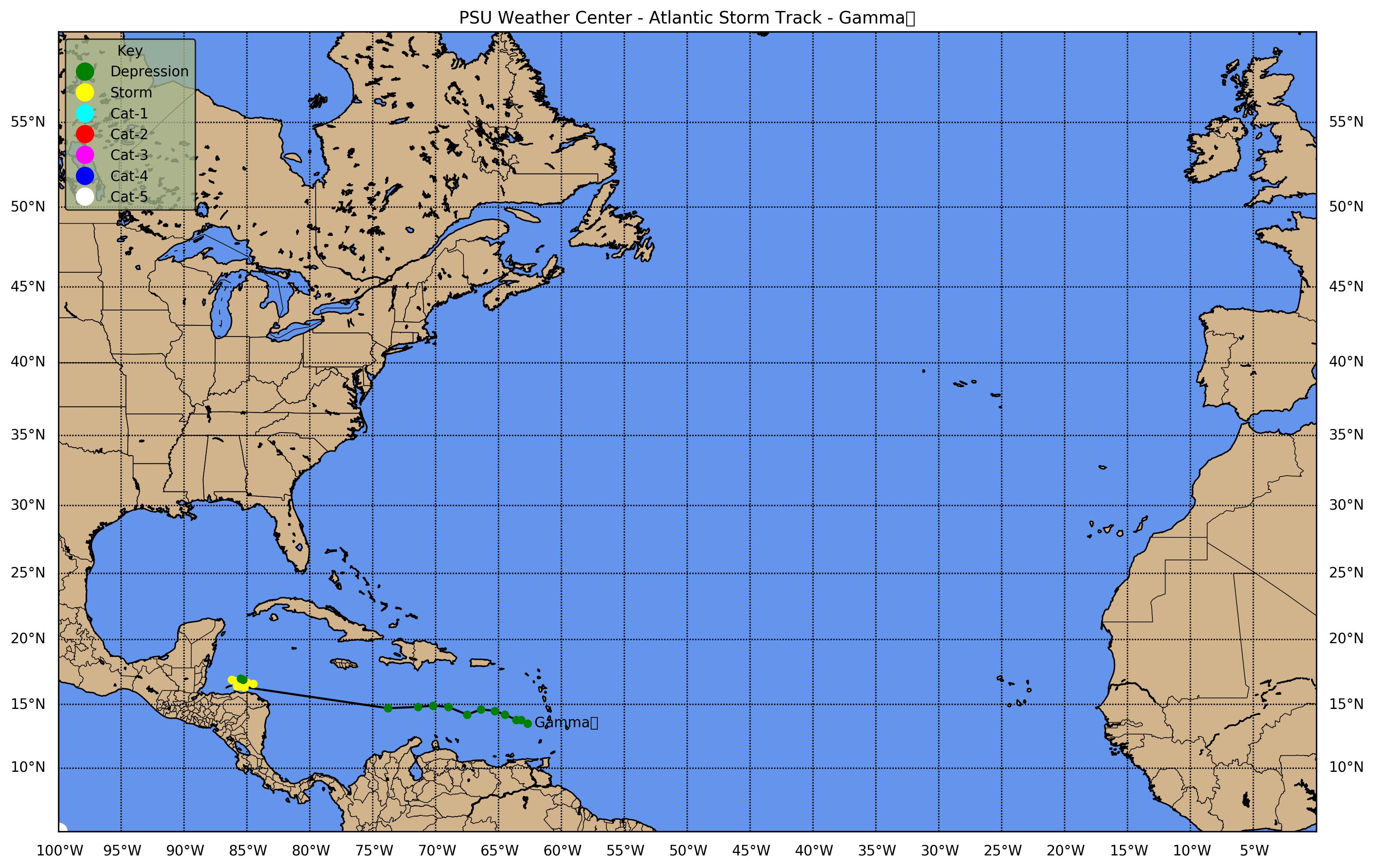
Tropical Storm Gamma (Nov 18-21)
Tropical Storm Delta (Nov 23-28)
Hurricane Epsilon (Nov 29 - Dec 8)
Tropical Storm Zeta (Dec 30 - Jan 6 2006)
Click the above storm track map once to view a larger image and then click that image for a greatly expanded image
Tropical Storm Arlene (8-13 June 2005)

[GIF] Track Map Position/Speed Summary Large Satellite View Zoomed IR Satellite View [MPG] GOES-E IR Satellite Loop
Radar: [MPG]NEXRAD Composite Base Reflectivity
Tropical Storm Bret (28-30 June 2005)

[GIF] Track Map Position/Speed Summary Large Satellite View Zoomed IR Satellite View [MPG] GOES-E IR Satellite Loop
Tropical Storm Cindy (3-8 July 2005)

[GIF] Track Map Position/Speed Summary Large Satellite View Zoomed IR Satellite View [MPG] GOES-E IR Satellite Loop
Radar: [MPG] NEXRAD Composite Base Reflectivity
Hurricane Dennis (5-13 July 2005)

[GIF] Track Map Position/Speed Summary Large Satellite View Zoomed IR Satellite View [MPG] GOES-E IR Satellite Loop
Zoomed Visible Satellite(FL) Large Satellite View(FL) Zoomed IR Satellite(FL)
Radar: [MPG] NEXRAD Composite Base Reflectivity [MPG] Eglin AFB (EVX) Base Reflectivity [MPG] Eglin AFB (EVX) Radial Velocity
Hurricane Emily (11-21 July 2005)

[GIF] Track Map Position/Speed Summary Large Satellite View Zoomed IR Satellite View [MPG] GOES-E IR Satellite Loop
Zoomed Visible Satellite(MX/TX) Large Satellite View(MX/TX) Zoomed IR Satellite(MX/TX)
Radar: [MPG] Brownsville (BRO) Base Reflectivity [MPG] Brownsville (BRO) Radial Velocity Brownsville (BRO) Storm Total Precipitation
Tropical Storm Franklin (21-29 July 2005)

[GIF] Track Map Position/Speed Summary Large Satellite View Zoomed IR Satellite View [MPG] GOES-E IR Satellite Loop
Tropical Storm Gert (23-25 July 2005)

[GIF] Track Map Position/Speed Summary Large Satellite View Zoomed IR Satellite View [MPG] GOES-E IR Satellite Loop
Radar: [MPG]NEXRAD Composite Base Reflectivity
Tropical Storm Harvey (2-8 August 2005)

[GIF] Track Map Position/Speed Summary Large Satellite View Zoomed IR Satellite View [MPG] GOES-E IR Satellite Loop
Hurricane Irene (4-18 August 2005)

[GIF] Track Map Position/Speed Summary Large Satellite View Zoomed IR Satellite View [MPG] GOES-E IR Satellite Loop
Tropical Depression Ten (13-14 August 2005)

[GIF] Track Map Position/Speed Summary Large Satellite View Zoomed IR Satellite View [MPG] GOES-E IR Satellite Loop
Tropical Storm Jose (22-23 August 2005)

[GIF] Track Map Position/Speed Summary Large Satellite View Zoomed IR Satellite View [MPG] GOES-E IR Satellite Loop
Hurricane Katrina (23-31 August 2005)

[GIF] Track Map Position/Speed Summary Large Satellite View Zoomed IR Satellite View [MPG] GOES-E IR Satellite Loop
[MPG] GOES-E Color IR Satellite Loop
JSANI Satellite Loops: FL Vis (25Aug) [MPG] Cat-5 Vis (28Aug) [MPG] LA Vis (29Aug)
FLASH Satellite Loops: FL Vis (25Aug) [MPG] Cat-5 Vis (28Aug) [MPG] LA Vis (29Aug)
Meteograms: [GIF] Miami, FL [GIF] Marathon, FL [GIF] Mobile, AL [GIF] Biloxi, MS [GIF] New Orleans, LA
NEXRAD Composite Base Reflectivity: [MPG] S. Florida [MPG] E. U.S.
Radar - Miami (AMX): [MPG] Base Reflectivity [MPG] Radial Velocity [GIF] Storm Total Precipitation
Radar - Mobile (MOB): [MPG] Base Reflectivity [MPG] Radial Velocity [GIF] Storm Total Precipitation
Radar - New Orleans (LIX): [MPG] Base Reflectivity [MPG] Radial Velocity [GIF] Storm Total Precipitation
Note: New Orleans radar went down on 29 Aug 2005 at 1359Z.

T.D. Thirteen/T. S. Lee (28-29 August/1-2 September 2005)

[GIF] Track Map Position/Speed Summary Large Satellite View Zoomed IR Satellite View [MPG] GOES-E IR Satellite Loop
Hurricane Maria (1-10 September 2005)

[GIF] Track Map Position/Speed Summary Large Satellite View Zoomed IR Satellite View [MPG] GOES-E IR Satellite Loop
Hurricane Nate (5-10 September 2005)

[GIF] Track Map Position/Speed Summary Large Satellite View Zoomed IR Satellite View [MPG] GOES-E IR Satellite Loop
Hurricane Ophelia (6-18 September 2005)

[GIF] Track Map Position/Speed Summary Large Satellite View Zoomed IR Satellite View [MPG] GOES-E IR Satellite Loop
GOES-E Color IR Satellite Loop
JSANI Satellite Loops: 8 Sep Vis 9 Sep Vis 10 Sep Vis 11 Sep Vis 12 Sep Vis 13 Sep Vis
14 Sep Vis 15 Sep Vis 16 Sep Vis 17 Sep Vis
FLASH Satellite Loops: 8 Sep Vis 9 Sep Vis 10 Sep Vis 11 Sep Vis 12 Sep Vis 13 Sep Vis
14 Sep Vis 15 Sep Vis 16 Sep Vis 17 Sep Vis
NEXRAD Composite Base Reflectivity: [MPG] E. Coast
Radar - Melbourne (MLB): [MPG] Base Reflectivity [MPG] Radial Velocity [GIF] Storm Total Precipitation
Radar - Wilmington (LTX): [MPG] Base Reflectivity [MPG] Radial Velocity [GIF] Storm Total Precipitation
Hurricane Philippe (18-24 September 2005)

[GIF] Track Map Position/Speed Summary Large Satellite View Zoomed IR Satellite View [MPG] GOES-E IR Satellite Loop
Hurricane Rita (18-26 September 2005)

[GIF] Track Map Position/Speed Summary Large Satellite View Zoomed IR Satellite View [MPG] GOES-E Color IR Satellite Loop
DSANI Satellite Loops: 20 Sep Vis 21 Sep Vis 22 Sep Vis 23 Sep Vis 24 Sep Vis
FLASH Satellite Loops: 20 Sep Vis 21 Sep Vis 22 Sep Vis 23 Sep Vis 24 Sep Vis
Radar - Key West (BYX): [MPG] Reflectivity [MPG] Radial Velocity [GIF] Storm Total Precipitation
Radar - Lake Charles (LCH): [MPG] Reflectivity [MPG] Radial Velocity [GIF] Storm Total Precipitation
Tropical Depression Nineteen (30 September - 2 October 2005)

[GIF] Track Map Position/Speed Summary Large Satellite View Zoomed IR Satellite View [MPG] GOES-E IR Satellite Loop
Hurricane Stan (1-5 October 2005)

[GIF] Track Map Position/Speed Summary Large Satellite View Zoomed IR Satellite View [MPG] GOES-E IR Satellite Loop
Tropical Storm Tammy (5-6 October 2005)

[GIF] Track Map Position/Speed Summary Large Satellite View Zoomed IR Satellite View [MPG] GOES-E IR Satellite Loop
Subtropical Depression Twenty-Two (8-9 October 2005)

[GIF] Track Map Position/Speed Summary Large Satellite View Zoomed IR Satellite View [MPG] GOES-E IR Satellite Loop
Hurricane Vince (9-11 October 2005)

Position/Speed Summary Large Satellite View Zoomed IR Satellite View [MPG] GOES-E IR Satellite Loop
Hurricane Wilma (15-25 October 2005)

[GIF] Track Map Position/Speed Summary Large Satellite View Zoomed IR Satellite View [MPG] GOES-E IR Satellite Loop
[MPG] GOES-E Color IR Satellite Loop
JSANI Satellite Loops: 19 Oct Vis 20 Oct Vis 21 Oct Vis 22 Oct Vis 23 Oct Vis 24 Oct Vis
FLASH Satellite Loops: 19 Oct Vis 20 Oct Vis 21 Oct Vis 22 Oct Vis 23 Oct Vis 24 Oct Vis
Radar - Key West (BYX): [MPG] Reflectivity [MPG] Radial Velocity [GIF] Storm Total Precipitation
Radar - Miami (AMX): [MPG] Reflectivity [MPG] Radial Velocity [GIF] Storm Total Precipitation
Tropical Storm Alpha (22-24 October 2005)

[GIF] Track Map Position/Speed Summary Large Satellite View Zoomed IR Satellite View [MPG] GOES-E IR Satellite Loop
Hurricane Beta (27-31 October 2005)

[GIF] Track Map Position/Speed Summary Large Satellite View Zoomed IR Satellite View [MPG] GOES-E IR Satellite Loop
Tropical Storm Gamma (14-16/18-21 November 2005)

[GIF] Track Map Position/Speed Summary Large Satellite View Zoomed IR Satellite View [MPG] GOES-E IR Satellite Loop
Tropical Storm Delta (23-28 November 2005)

[GIF] Track Map Position/Speed Summary Large Satellite View Zoomed IR Satellite View [MPG] GOES-E IR Satellite Loop
Hurricane Epsilon (29 November - 8 December 2005)

[GIF] Track Map Position/Speed Summary Large Satellite View Zoomed IR Satellite View [MPG] GOES-E IR Satellite Loop
Tropical Storm Zeta (30 December 2005 - 6 January 2006)

[GIF] Track Map Position/Speed Summary Large Satellite View Zoomed IR Satellite View [MPG] GOES-E IR Satellite Loop